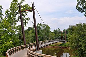
Capital Area Greenway facts for kids
The Capital Area Greenway is a cool system of trails and parks in Raleigh, North Carolina. It's like a big, green network that helps connect different parts of the city. Started in 1974, it now stretches over 112 miles (161 km) and covers more than 3,800 acres (12 km²)!
This greenway system also links up with similar trails in nearby areas. Some parts of it are even part of bigger national trails, like the East Coast Greenway and the Mountains-to-Sea Trail. It's a great place for walking, running, biking, and enjoying nature.
How the Greenway Started
In the early 1970s, people in Raleigh started to worry about how fast their city was growing. They were concerned that new buildings and roads might take away the city's beautiful natural spaces. Raleigh's population was around 118,000 back then. By 2015, it had grown to almost half a million!
To address these worries, city leaders came up with "The Greenway Master Plan." This idea began when the Raleigh City Council and the Parks and Recreation Advisory Commission asked for a special report. It was called "Raleigh: The Park with a City in It." This report suggested that Raleigh's natural features could help create a network of parks and open spaces. This would make the city even better and provide fun places for everyone in the future.
The next year, the Raleigh City Council asked for another report called "Capital City Greenway." This report looked at how to manage water from the city's two main creeks, Crabtree and Walnut. It also focused on preventing floods, protecting wildlife, and creating a trail system. The main idea was to have green, open spaces that would be homes for animals. These areas would also act as a buffer between homes and creeks that sometimes overflowed. For example, a trail was planned near the Crabtree Valley Mall, which often flooded during heavy rains.
The City of Raleigh began buying land for this project in 1974. This was the start of what would become one of the nation's first citywide greenway systems!
By the end of 1975, the city had connected a few separate paths. Over the next 30 years, the city and Wake County kept investing in the project. This led to the amazing system we have today, with over 114 miles of paths on more than 3,700 acres of protected land. Raleigh is the main city in Wake County.
Now, the main goal is to connect all the paths that have already been built. "The emphasis today is on tying up those loose ends," said Vic Lebsock, who was the Senior Greenway Planner for Raleigh in 2017. This means making sure all the trails link up smoothly for everyone to enjoy.
Greenway Trails You Can Explore
The Capital Area Greenway has many different trails, each with its own length. Here's a list of some of the trails in the system:
| Name of Trail | Length (Miles) |
|---|---|
| Abbotts Creek | 2.9 |
| Baileywick | 0.6 |
| Beaver Dam | 0.8 |
| Birch Ridge Connector | 0.3 |
| Centennial Bikeway Connector | 2.3 |
| Crabtree Creek | 14.6 |
| East Fork Mine Creek | 2.5 |
| Edwards Mill Connector | 1.3 |
| Garden Street | 0.7 |
| Hare Snipe Creek | 2.3 |
| Honeycutt | 3.8 |
| House Creek | 2.8 |
| Lake Johnson East Loop | 2.8 |
| Lake Johnson West Loop | 2.1 |
| Lake Lynn Loop | 1.9 |
| Little Rock | 1.6 |
| Marsh Creek | 0.3 |
| Martin Street Connector | 0.4 |
| Mine Creek | 4.1 |
| Neuse River | 27.5 |
| Reedy Creek | 5.0 |
| Richland Creek | 3.1 |
| Rocky Branch | 3.8 |
| Shelley Lake Loop | 2.1 |
| Simms Branch | 1.7 |
| Snelling Branch | 0.8 |
| Spring Forest | 0.4 |
| Wakefield | 1.4 |
| Walnut Creek | 15.6 |
 | Bessie Coleman |
 | Spann Watson |
 | Jill E. Brown |
 | Sherman W. White |


