Carignan, Quebec facts for kids
Quick facts for kids
Carignan
|
||
|---|---|---|
|
City
|
||
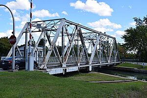
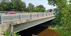
Bridge over Chambly canal in Carignan.
|
||
|
||
| Motto(s):
"Honneur et patrie"
(French for, "Honor and homeland") |
||
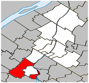
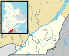
Location within La Vallée-du-Richelieu RCM.
|
||
| Country | ||
| Province | ||
| Region | Montérégie | |
| RCM | La Vallée-du-Richelieu | |
| Constituted | July 1, 1855 | |
| Government | ||
| • Type | Carignan City Council | |
| Area | ||
| • Total | 65.20 km2 (25.17 sq mi) | |
| • Land | 62.07 km2 (23.97 sq mi) | |
| Population
(2021)
|
||
| • Total | 11,740 | |
| • Density | 189.1/km2 (490/sq mi) | |
| • Pop 2016-2021 | ||
| • Dwellings | 4,375 | |
| Time zone | UTC−5 (EST) | |
| • Summer (DST) | UTC−4 (EDT) | |
| Postal code(s) |
J3L
|
|
| Area code(s) | 450 and 579 | |
| Highways |
||
Carignan is a city in southwestern Quebec, Canada. It is located on the Richelieu River in the La Vallée-du-Richelieu Regional County Municipality. Carignan is about 27 kilometers (17 miles) away from Montreal. In 2021, the city had a population of 11,740 people.
Carignan was first known as the Village Municipality of Chambly. This village was created in 1855. Later, in 1965, its name was changed to Carignan. This new name was chosen to honor the Carignan-Salières Regiment, a famous military group from the past.
Contents
History of Carignan
The city of Carignan was officially created on July 1, 1855. At that time, it was part of a larger area called Chambly. The original name for Carignan was Saint-Joseph-de-Chambly, and it kept this name for more than 100 years!
On June 6, 1871, a large section of Saint-Joseph-de-Chambly, along with a part of Saint-Bruno-de-Montarville, separated to form a new town called Saint-Basile-le-Grand. Finally, on December 31, 1965, the name Saint-Joseph-de-Chambly was changed to the new city of Carignan.
Geography of Carignan
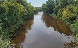
Carignan has small city areas surrounded by lots of farmland. Farmers here mostly grow crops like corn, wheat, and soybeans. The city is located next to the Acadia and Richelieu Rivers. These two rivers meet, forming a small delta.
At the tip of this delta, you'll find one of the city's four islands: Goyer Island. This island used to be called Grande Isle because it is the largest. Other islands include Demers Island and Île Aux Lièvres. Between these islands, there are channels with unique plants and animals.
An interesting fact about Carignan is that the city of Chambly cuts it into two separate parts. There's a gap of 1.8 kilometers (1.1 miles) on chemin de la Grande-Ligne and 3 kilometers (1.9 miles) along the Richelieu River.
Population and Languages
In the 2021 Census, Carignan had a population of 11,740 people. This was a big increase of 24.1% from its population in 2016, which was 9,462 people. The city has a land area of 62.07 square kilometers (23.97 square miles). This means there were about 189.1 people living in each square kilometer in 2021.
Mother Tongue Languages (2021)
Most people in Carignan speak French as their first language.
| Language | Population | Pct (%) |
|---|---|---|
| French only | 9,755 | 83.1% |
| English only | 590 | 5.0% |
| Both English and French | 210 | 1.8% |
| Other languages | 1,045 | 8.9% |
Getting Around
The CIT Chambly-Richelieu-Carignan provides bus services for people living in Carignan. These buses help residents travel within the city and to nearby areas.
See also
 In Spanish: Carignan (Quebec) para niños
 | Victor J. Glover |
 | Yvonne Cagle |
 | Jeanette Epps |
 | Bernard A. Harris Jr. |


