Acadia River facts for kids
Quick facts for kids Acadia River |
|
|---|---|

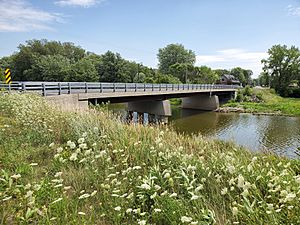
Rivière L’Acadie in Saint-Jean-sur-Richelieu, Québec
|
|
| Country | Canada |
| Physical characteristics | |
| Main source | Canada-US border |
| River mouth | Richelieu River, Chambly, Quebec 45°29′01″N 73°16′09″W / 45.48361°N 73.26917°W |
| Length | 82 km (51 mi) |
| Basin features | |
| River system | St. Lawrence River |
The Acadia River is a river in Quebec, Canada. It flows north for over 82 km (51 mi). The river passes through seven towns and areas. These include La Vallée-du-Richelieu, Les Jardins-de-Napierville, and Le Haut-Richelieu. The river is located in Montérégie, south of the St. Lawrence River. The Acadia River eventually flows into the Richelieu River near Carignan, just north of Chambly.
Contents
How the River Got its Name
The name of a place is called a toponym. The Acadia River has had many names over time.
Early Names
In 1673, people called it "Mount Royal River." This was in the first land records for the Chambly Lordship. Settlers in the southern part called it "River of Morels." This name came from a wild plant with black berries that grew along the river. Later, this name changed to "River Morales."
When the British took over from New France, they called it "Montreal River." This was a slightly different translation of "River of Mount Royal." French settlers also used names like "River of Montreal" or "Little Montreal River."
The Name "Acadia"
Around the mid-1800s, a part of the river was named "River of Acadia." This was because Acadians settled there after 1768. These settlers had been forced to leave their homes. They called their new land "La Cadie" or "New Cadie." This was to remember their original home, which was called Acadia.
What "Acadia" Means
In 1524, an explorer named Giovanni da Verrazzano explored North America's East coast. A map from 1548 showed the name "Arcadia" for parts of Maryland and Virginia. The name "Arcadia" comes from an ancient Greek region. This region was known for its peaceful and happy nature.
In 1604, Samuel de Champlain visited Acadia for the King of France. He changed the spelling to "Acadie" by dropping the "R." At that time, "Acadie" referred to the Nova Scotia peninsula. French people started settling Acadia in 1605.
In 1713, Acadia was given to England by the Treaty of Utrecht. In the mid-1700s, many Acadians were forced to leave their homes. This event is known as the "Great Upheaval." They were sent to British colonies along the American coast. By 1763, Acadia fully belonged to the British. Today, Acadia mainly refers to parts of New Brunswick, Nova Scotia, and Prince Edward Island. These areas are home to the descendants of the original French Acadians.
Official Registration of the Name
In 1965, the Geographic Board of Canada officially named the river "L'Acadie River." This was requested by the Historical Society of the Richelieu Valley. However, some people still used the old name, "Little Montreal River."
The name "River Acadia" was officially recorded on December 5, 1968. This was done by the "Commission de toponymie du Quebec."
River's Journey
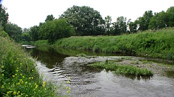
The Acadia River starts from small streams near the Canada-United States border. This is in the Hemmingford Township near Hemmingford. It flows north, mostly parallel to the Richelieu River on its west side.
The river flows through farms and forests. It also passes through several towns. These include Napierville, Acadia, and Chambly. In the past, there were old roads along both sides of the river. In winter, people used ice roads on the river for travel. This helped them avoid rough or unplowed roads.
The Acadia River flows through seven municipalities:
- Hemmingford
- Saint-Patrice-de-Sherrington
- Saint-Cyprien-de-Napierville
- Napierville
- Saint-Jean-sur-Richelieu (including the Saint-Luc and Acadia areas)
- Carignan
- Chambly
The river's path is winding between the village of Acadia and Chambly Road. This part of the river can flood easily because it is quite flat.
In Saint-Jean-sur-Richelieu, there is a special natural area along the river. It covers about 6 hectares (15 acres). This area is protected to keep its natural beauty. Rules prevent cutting trees or building new structures there.
The Acadia River flows through the historic village of Acadie. The Acadians who settled here in 1782 built their church near the river.
Where the River Ends
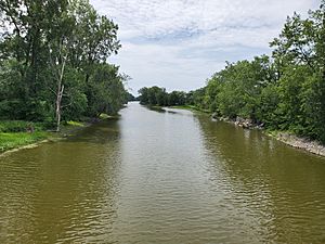
After winding through the Montérégie plain, the Acadia River flows into the Richelieu River. This happens at the mouth of the Chambly Basin, in the city of Carignan. In its final section, the river runs along Route 223. This road goes around Demers Island and Grande Île (Great Island). These islands are located north of the Chambly Basin.
See Also
 | Claudette Colvin |
 | Myrlie Evers-Williams |
 | Alberta Odell Jones |


