Carneros Creek (Napa River tributary) facts for kids
Quick facts for kids Carneros Creek |
|
|---|---|

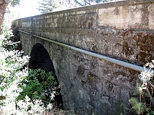
Historic Old Sonoma Road bridge over Carneros Creek in 2010
|
|
|
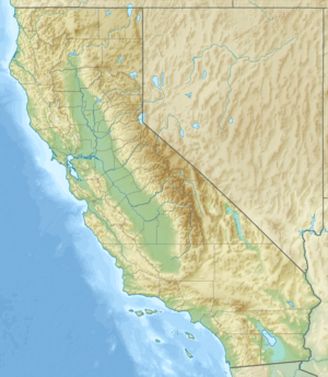
Location of the mouth of Carneros Creek in California
|
|
| Native name | Spanish: Arroyo de los Carneros |
| Country | United States |
| State | California |
| Region | Napa County, California |
| City | Napa |
| Physical characteristics | |
| Main source | Mayacamas Mountains 1,500 ft (460 m) 38°1′58″N 122°24′42″W / 38.03278°N 122.41167°W |
| River mouth | Napa River 3 ft (0.91 m) 38°13′17″N 122°18′43″W / 38.22139°N 122.31194°W |
| Basin features | |
| Basin size | 170 sq mi (440 km2) |
Carneros Creek is a stream that flows from the southern part of the Mayacamas Mountains in Napa County, California. Its name, Arroyo de los Carneros, means "sheep stream" in Spanish. This creek is the southernmost stream that flows into the Napa River. It joins the Napa River about 2.5 miles (4 km) north of San Pablo Bay.
History of Carneros Creek
The area around Carneros Creek has a rich history tied to early land grants. In 1836, a Mexican land grant called Los Carneros was established. This name, meaning "sheep," shows how important sheep farming was in the region long ago.
- One part of this land, called Rancho Rincon de los Carneros, was given to Nicolas Higuera.
- Another nearby area, Rancho Entre Napa, was also granted to Higuera.
- Carneros Creek also formed the border for Rancho Huichica, granted to Jacob P. Leese in 1841. Leese was one of the first American pioneers to build a house in San Francisco.
- Later, a large ranch from Napa to Yountville, which included parts of Carneros Creek, was granted to Salvador Vallejo.
These land grants show how the creek was an important landmark for marking property boundaries in the past.
Understanding the Carneros Creek Watershed
A watershed is an area of land where all the water drains into a single stream, river, or lake. Think of it like a giant bowl where all the rain and melted snow eventually flow into one main waterway.
- The main part of Carneros Creek is about 9.8 miles (15.8 km) long.
- The entire area that drains into Carneros Creek is about 8.9 square miles (23 km²).
- The highest point in this watershed is about 1,660 feet (506 meters) above sea level.
- As the creek flows towards the Napa River, its elevation drops to almost sea level.
- The lowest 1,640 feet (500 meters) of the creek are surrounded by special walls called flood levees. These levees help control the water and prevent flooding.
Wildlife and Ecology of Carneros Creek
Carneros Creek is a vital home for a special type of fish called steelhead trout (Oncorhynchus mykiss). These trout are known for their amazing journey between fresh and saltwater.
- Steelhead trout are anadromous. This means they are born in freshwater streams like Carneros Creek.
- They then travel to the ocean to live and grow for a few years.
- After growing big in the ocean, they return to the same freshwater stream where they were born to lay their own eggs.
- In Carneros Creek, young steelhead trout spend about two years in the freshwater before heading out to the sea.
- The middle part of the creek, from Old Sonoma Road upstream for about 4.2 miles (6.8 km), has water all year round. This section is where the trout live throughout the year, even when other parts of the creek might dry up in summer and fall.
 | Leon Lynch |
 | Milton P. Webster |
 | Ferdinand Smith |


