Carrington Island facts for kids

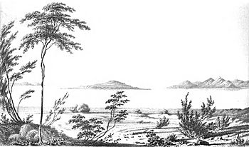
Carrington Island seen from Stansbury Island during the Stansbury Expedition (1850)
|
|
| Geography | |
|---|---|
| Location | Great Salt Lake |
| Coordinates | 41°0′24.9438″N 112°34′15.7584″W / 41.006928833°N 112.571044000°W |
| Area | 4.8 km2 (1.9 sq mi) |
| Length | 2.7 km (1.68 mi) |
| Width | 3.2 km (1.99 mi) |
| Administration | |
| State | Utah |
| County | Tooele |
Carrington Island is a large island located in the Great Salt Lake in northern Utah, United States. It covers about 1,200 acres (4.8 square kilometers). This makes it the fourth-largest island in the lake.
Island History
Carrington Island is named after Albert Carrington. He was an important early settler and leader in Utah. A high point on the island, called Lambourne's Rock, is named after a painter named Alfred Lambourne.
In 1932, a man named Charles Stoddard tried to live on the island. He built a small cabin there. However, he left the island because the well he dug only produced saltwater.
During World War II, the United States Army used Carrington Island. They used it as a place to practice bombing. Because of this, you can still see many bomb craters on the island's surface. The island was never fully cleaned up because it is far away. This means old military items might still be present. Some places on the island, like SAC Bay and SAC Point, got their names from the Strategic Air Command. This was a military group that used the island.
Today, people who collect brine shrimp from the lake use a radio repeater on the island's highest point. This helps them communicate while working.
Visiting Carrington Island
About half of Carrington Island (542 acres) is privately owned. It belongs to a company called Six Mile Ranch Co. The rest of the island is public land. It is managed by the Bureau of Land Management. This is a government agency that looks after public lands.
Sometimes, sandbars connect Carrington Island to Stansbury Island and to the mainland. However, these sandbars are cut by canals.
 | Misty Copeland |
 | Raven Wilkinson |
 | Debra Austin |
 | Aesha Ash |

