Stansbury Island facts for kids

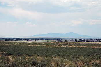
View of Stansbury Island from southeast at Erda, Utah-(~20 mi)
|
|
| Etymology | Howard Stansbury |
|---|---|
| Geography | |
| Location | Great Salt Lake |
| Coordinates | 40°49′47″N 112°29′52″W / 40.82972°N 112.49778°W |
| Highest elevation | 6,647 ft (2,026 m) |
| Administration | |
|
United States
|
|
| State | Utah |
Stansbury Island is the second largest island in the Great Salt Lake in Utah. It's located in Tooele County. Even though a dirt causeway connects it to the mainland, it's still called an island. The island was named after Howard Stansbury. He led a government group that explored the lake in 1849.
Stansbury Island is a great place for outdoor adventures! You can find a biking trail there. There are also ancient Petroglyphs (rock carvings) and two caves to explore. The highest point on the island is Castle Rock, which is 6,647 feet above sea level. You can even go camp in most areas.
Exploring Stansbury Island
Stansbury Island is about 11.5 miles (18.5 km) long and 4.5 miles (7.2 km) wide. Its total area is about 22,314 acres (90.3 km²). The island is like a desert mountain range. You can find a few fresh water springs on the eastern side. However, the western side doesn't have much water.
No people live on the island. Instead, it's used as a place for sheep to eat during the winter. The island gets about six inches of rain or snow each year.
The Island's Ancient Rocks
The rocks on Stansbury Island are very, very old. Most of them formed during a time called the early Paleozoic Era. This era began over 540 million years ago!
- Some of the oldest rocks, from the Precambrian time, are at the very north tip. You can also see them along part of the northeast shore.
- A hard rock called quartzite on the southern part of the island formed during the Devonian Period. This was about 419 to 359 million years ago.
- The northern third of the island has rocks from the Cambrian Period. This period was even older, from about 541 to 485 million years ago. These rocks include limestone, shale, and dolomite.
- The rest of the island has rocks from the late Cambrian to the late Mississippian Period. These rocks are also mostly limestone, dolomite, quartzite, and shale.
The southern part of the island was folded into a shape like an upside-down U. This happened because of huge forces in the Earth. The northern part of the island has many fault blocks. These are large sections of rock that have moved along cracks in the Earth's crust. These movements helped shape the island over millions of years.
 | George Robert Carruthers |
 | Patricia Bath |
 | Jan Ernst Matzeliger |
 | Alexander Miles |

