Cartes facts for kids
Quick facts for kids
Cartes
|
||
|---|---|---|

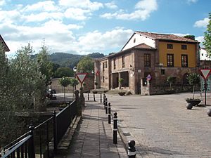
Cartes' Consistorial House
|
||
|
||

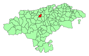
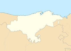
Location of Cartes
|
||
| Country | ||
| Autonomous community | ||
| Province | ||
| Comarca | Besaya valley | |
| Judicial district | Torrelavega | |
| Capital | Cartes | |
| Area | ||
| • Total | 19.02 km2 (7.34 sq mi) | |
| Elevation | 40 m (130 ft) | |
| Population
(2018)
|
||
| • Total | 5,778 | |
| • Density | 303.79/km2 (786.80/sq mi) | |
| Time zone | UTC+1 (CET) | |
| • Summer (DST) | UTC+2 (CEST) | |
| Postal code |
39311
|
|
Cartes is a town and municipality in Cantabria, a region in northern Spain. It is known for its beautiful traditional architecture. In 2009, about 5,118 people lived there. By 2018, the population had grown to 5,778 residents.
Contents
Where is Cartes?
Cartes is located in the Besaya valley area of Cantabria. It sits about 40 meters (131 feet) above sea level. The municipality covers an area of 19.02 square kilometers (7.34 square miles).
Location in Spain
Cartes is part of the autonomous community of Cantabria. This means it has its own government within Spain. It is also in the province of Cantabria.
Nearby Cities
The closest major city is Torrelavega. Cartes is part of Torrelavega's judicial district. This means legal matters for Cartes are handled in Torrelavega.
How Cartes is Governed
Like other towns in Spain, Cartes is led by a mayor. The mayor is called an Alcalde.
Current Leadership
As of 2007, the mayor of Cartes was Saturnino Castanedo Saiz. He was a member of the PSC-PSOE political party. This party is part of the larger Socialist Party in Spain.
Living in Cartes
The postal code for Cartes is 39311. The town uses CET (+1 UTC) in winter. In summer, it switches to CEST (+2 UTC).
See also
 In Spanish: Cartes para niños


