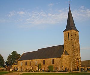
Carville facts for kids
Quick facts for kids
Carville
|
|
|---|---|
|
Part of Souleuvre-en-Bocage
|
|
| Country | France |
| Region | Normandy |
| Department | Calvados |
| Arrondissement | Vire |
| Canton | Condé-sur-Noireau |
| Commune | Souleuvre-en-Bocage |
| Area
1
|
10.43 km2 (4.03 sq mi) |
| Population
(2008)
|
348 |
| • Density | 33.37/km2 (86.42/sq mi) |
| Time zone | UTC+01:00 (CET) |
| • Summer (DST) | UTC+02:00 (CEST) |
| Postal code |
14350
|
| Elevation | 73–206 m (240–676 ft) (avg. 153 m or 502 ft) |
| 1 French Land Register data, which excludes lakes, ponds, glaciers > 1 km2 (0.386 sq mi or 247 acres) and river estuaries. | |
Carville is a small area in France. It is known as a commune, which is like a local town or district. Carville is located in the northwest part of France.
It is found in the region called Basse-Normandie. This region is known for its green landscapes. Carville is also part of the Calvados department. A department is a smaller administrative area within a region.
About Carville
Carville is a quiet place with a small population. In 2008, about 348 people lived there. The total area of Carville is around 10.43 square kilometers. That's about 4 square miles.
Where is Carville?
Carville is in the Calvados department. This department is part of the Basse-Normandie region. It is in the northwestern part of France. The nearest larger town is Souleuvre-en-Bocage.
How High is Carville?
The land in Carville is not flat. Its elevation, or how high it is above sea level, changes. The lowest point in Carville is 73 meters (about 240 feet) high. The highest point reaches 206 meters (about 676 feet). The average elevation is 153 meters (about 502 feet).
How Carville is Governed
Like all communes in France, Carville is part of a larger system. It belongs to the Vire arrondissement. An arrondissement is a type of administrative district. It also falls under the Condé-sur-Noireau canton. A canton is another administrative division, often used for elections.


