Cataract, Indiana facts for kids
Quick facts for kids
Cataract, Indiana
|
|
|---|---|

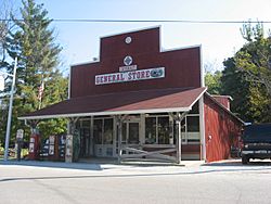
The community's general store
|
|
| Country | United States |
| State | Indiana |
| County | Owen |
| Township | Jennings |
| Elevation | 771 ft (235 m) |
| Time zone | UTC-5 (Eastern (EST)) |
| • Summer (DST) | UTC-4 (EDT) |
| ZIP code |
47460
|
| Area code(s) | 812, 930 |
| GNIS feature ID | 432235 |
Cataract is a small, unincorporated community located in Jennings Township, within Owen County, in the U.S. state of Indiana. An unincorporated community is a place where people live, but it doesn't have its own local government like a city or town.
The Story of Cataract
Cataract was officially planned and laid out in 1851. This means its streets and lots were mapped out for people to build homes and businesses. The community got its name from the amazing waterfalls close by. A "cataract" is another word for a large, powerful waterfall.
A post office was opened in Cataract in 1846. This office helped people send and receive mail. It served the community for many years. However, the post office eventually closed down in 1936.
Where is Cataract Located?
Cataract is found about 6 miles (9.7 km) south of a town called Cloverdale. You can find its exact spot on a map using these coordinates: 39°25′39″N 86°48′59″W / 39.42750°N 86.81639°W. It sits at an elevation of about 235 meters (771 feet) above sea level.
 | May Edward Chinn |
 | Rebecca Cole |
 | Alexa Canady |
 | Dorothy Lavinia Brown |


