Cataviña facts for kids
Quick facts for kids
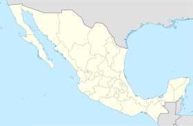
Cataviña, Baja California
|
|
|---|---|
|
Town
|
|
| Country | |
| State | Baja California |
| Municipality | San Quintín |
| Elevation | 1,841 ft (561 m) |
| Population
(2010)
|
|
| • Town | 159 |
| • Urban | 0 |
| Time zone | UTC-8 (Northwest US Pacific) |
| • Summer (DST) | UTC-7 (Northwest) |
Cataviña is a small town in San Quintín Municipality, Baja California, Mexico. It is known for its unique desert landscape.
Contents
Where is Cataviña Located?
Cataviña is found in the Baja California desert. It is about 118 kilometers (74 miles) south of El Rosario. It is also 106 kilometers (66 miles) north of the turn-off for Federal Highway 12. This highway leads to Bahía de los Ángeles. You can reach Cataviña by taking Federal Highway 1.
What is the Economy Like?
The main ways people make a living in Cataviña are through tourism and ranching. There is a ranch called Rancho Santa Inés nearby. This ranch is an ejido, which means the land is owned and used by the community. Sometimes, local sellers also offer gasoline from large barrels.
Visiting Cataviña
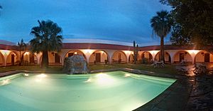
Cataviña has a good hotel built to help tourism. It was developed by the Mexican government. The area is perfect for people who love nature and outdoor adventures.
Near the town, you can find ancient cave paintings. There is also a special area with huge rocks mixed with desert plants. This makes Cataviña a great spot for ecotourism, which is travel focused on enjoying nature. Because Cataviña is in a remote area, it's a good idea to plan your trip carefully.
Historical Missions
Cataviña is close to two important historical missions. These missions were built a long time ago. They are:
- Misión San Fernando Rey de España de Velicatá
- Misión Santa María de los Ángeles
See also
 In Spanish: Cataviñá para niños


