Catawba, Wisconsin facts for kids
Quick facts for kids
Catawba
|
|
|---|---|

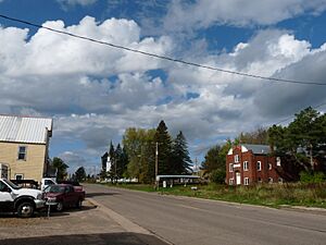
Facing west on 8, with town hall/museum on right
|
|

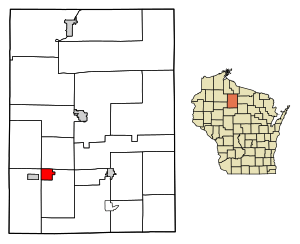
Location of Catawba in Price County, Wisconsin
|
|
| Country | |
| State | |
| County | Price |
| Area | |
| • Total | 4.44 sq mi (11.49 km2) |
| • Land | 4.44 sq mi (11.49 km2) |
| • Water | 0.00 sq mi (0.00 km2) |
| Population
(2010)
|
|
| • Total | 110 |
| • Estimate
(2019)
|
100 |
| • Density | 22.54/sq mi (8.70/km2) |
| Time zone | UTC-6 (Central (CST)) |
| • Summer (DST) | UTC-5 (CDT) |
| Area code(s) | 715 & 534 |
| FIPS code | 55-13175 |
Catawba is a small village in Price County, Wisconsin, United States. In 2010, about 110 people lived there. The village is part of the larger Town of Catawba.
Contents
Discover Catawba's Location
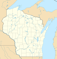
Catawba is found at coordinates 45.535969 degrees north and 90.530445 degrees west. This means it's in the northern part of the United States.
Land Area of Catawba
The village covers a total area of about 4.46 square miles (11.49 square kilometers). All of this area is land, with no large bodies of water inside the village limits.
Catawba's Past: A Look at Its History
Before 1884, the area where Catawba now stands was a thick forest. Only rivers and trails used by Native Americans cut through it. The government surveyed this wild land in the mid-1800s. Some Swedish immigrants settled near the Jump River before the railroad arrived.
How Catawba Got Its Name
The name Catawba is thought to come from a type of wine. Some say railroad workers, known as "gandy dancers" (who laid tracks), enjoyed this wine a lot. Others believe local lumberjacks drank it at a saloon nearby.
Growth with the Railroad
When the railroad was built around 1884, more people came to Catawba. Lumber camps and a sawmill opened. This brought more settlers to the area.
Early Community Life and Businesses
- The first school started in 1892 and grew to two rooms by 1902.
- By 1902, Peter Hammer had a sawmill called Red Birch Lumber Company.
- Peter and his wife Isabelle also ran the Commercial Hotel, which served lumber workers.
- Hammer also had a company store called the ACA store.
- Other early businesses included a lath mill (for thin strips of wood), a butcher shop, a saloon and pool hall, a barber shop, a soda fountain, and a general store with an opera house.
- A Lutheran church was formed in 1903, and a Catholic church was built around 1908.
- The Catawba State Bank opened in 1916.
Becoming an Official Village
The town hall was built in 1921. Catawba officially became a village in 1922. Over time, roads like Wisconsin Highway 14 and later U.S. Route 8 passed through the town. U.S. Route 8 was paved in 1949.
Catawba's Population Over Time
| Historical population | |||
|---|---|---|---|
| Census | Pop. | %± | |
| 1930 | 282 | — | |
| 1940 | 290 | 2.8% | |
| 1950 | 233 | −19.7% | |
| 1960 | 230 | −1.3% | |
| 1970 | 215 | −6.5% | |
| 1980 | 205 | −4.7% | |
| 1990 | 178 | −13.2% | |
| 2000 | 149 | −16.3% | |
| 2010 | 110 | −26.2% | |
| 2019 (est.) | 100 | −9.1% | |
| U.S. Decennial Census | |||
Who Lives in Catawba? (2010 Census)
In 2010, there were 110 people living in Catawba. These people lived in 60 households, with 31 of them being families. The village had about 24.7 people per square mile.
Most residents (100%) were White. A small number (0.9%) were Hispanic or Latino.
Households and Age in Catawba
- About 13.3% of households had children under 18.
- Many households (41.7%) were married couples living together.
- The average household had 1.83 people.
- The average family had 2.45 people.
- The average age in the village was 52 years old.
- About 13.6% of residents were under 18.
- About 17.3% were 65 years old or older.
- The population was almost evenly split between males (51.8%) and females (48.2%).
See also
 In Spanish: Catawba (Wisconsin) para niños
 | Jessica Watkins |
 | Robert Henry Lawrence Jr. |
 | Mae Jemison |
 | Sian Proctor |
 | Guion Bluford |


