
Cayos de Caña Gorda facts for kids
.jpg)
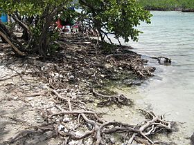
Cayo Aurora (western cay) from ferry boat
|
|

Census 2000 map of Cayos de Caña Gorda
|
|

Cayos de Caña Gorda
Location in Puerto Rico

Cayos de Caña Gorda
Location in Lesser Antilles

Cayos de Caña Gorda
Location in Caribbean
|
|
| Geography | |
|---|---|
| Coordinates | 17°56′32″N 066°52′17″W / 17.94222°N 66.87139°W |
| Administration | |
| Territory | Puerto Rico |

The Cayos de Caña Gorda (which means Caña Gorda Cays or Keys in English) are a group of three small islands. They are located off the southwestern coast of Puerto Rico. These islands are not lived on by people.
These cays are covered in mangrove trees. Mangroves are special trees and shrubs that grow in salty water. They are important for the environment. The islands are part of the Caranero area in the Guánica region of Puerto Rico.
Contents
What are the Cayos de Caña Gorda?
The Cayos de Caña Gorda are made up of three main islands. Each island has its own unique features. They are a popular spot for visitors looking for nature and quiet beaches.
Isla Ballena: The Eastern Cay
Isla Ballena is the island on the eastern side of the group. It is very close to the mainland of Puerto Rico. Only a narrow channel, about 66 feet (20 meters) wide, separates it from a place called Punta Ballena.
Cayo Aurora: The Western Cay
The western island is known as Cayo Aurora. In the 1970s, a family from Philadelphia named it Gilligan's Island. They named it after a popular TV show from that time.
Cayo Aurora is a great place for visitors. You can reach it by a short boat ride from the mainland. The boat trip is about 1,969 feet (600 meters) from Punta Jacinto. This island has public beaches where people can relax and enjoy the sun.
Cayo Honda: The Central Cay
Between Isla Ballena and Cayo Aurora is the third island. This middle island is called Cayo Honda. It connects the eastern and western parts of the group.
Size of the Islands
The total land area of all three Cayos de Caña Gorda combined is about 0.069 square miles. This is a small area, but it is home to many plants and animals. The islands are an important part of Puerto Rico's natural beauty.
Gallery
-
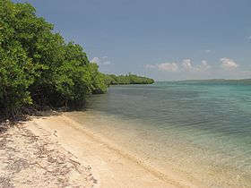
On the shore of Cayo Aurora
-
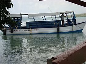
Ferry boat to Gilligan's Island
-
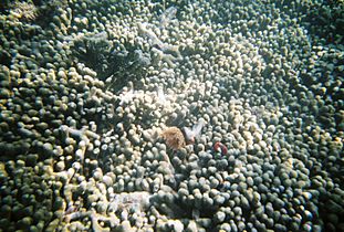
Coral formations behind Gilligan's Island
-
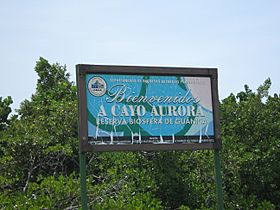
Welcome sign at boat landing of Cayo Aurora, mangrove forest in the background
-
Northern mangrove-covered shore of Cayo Aurora


.jpg)
.jpg)
See also
 In Spanish: Cayos de Caña Gorda para niños
