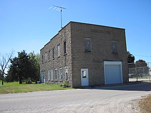
Cedar, Iowa facts for kids
Quick facts for kids
Cedar, Iowa
|
|
|---|---|

Cedar Hall
|
|
| Country | United States |
| State | Iowa |
| County | Mahaska |
| Elevation | 814 ft (248 m) |
| Time zone | UTC-6 (Central (CST)) |
| • Summer (DST) | UTC-5 (CDT) |
| ZIP code |
52543
|
| Area code(s) | 641 |
| GNIS feature ID | 455220 |
Cedar is a small, unincorporated community located in southeastern Mahaska County, Iowa, United States. This means it's a settlement that isn't officially part of a city or town government. It lies along Iowa Highway 23, a bit southeast of Oskaloosa, which is the main city and county seat of Mahaska County.
Even though it's a small place, Cedar has a few important buildings. You can find a Methodist church and a Christian Reformed church here. There's also a grain elevator, which is a tall building used to store grain like corn or soybeans from local farms.
History of Cedar
Early Days
Cedar got its own post office in 1874. This was an important step, as it meant people living in and around Cedar could send and receive mail more easily.
The Railroad Arrives
In late 1882, the Burlington and Western Railway reached Cedar. This was a special kind of train line called a narrow gauge railway. Narrow gauge tracks are closer together than regular tracks.
Later, in 1902, the railway tracks were changed to standard gauge, which is the width most trains use. The Chicago, Burlington and Quincy Railroad then took over this line. However, the train service to Cedar stopped in 1934 when the Burlington line was no longer used.
Population Changes
Over the years, the number of people living in Cedar has changed. In 1925, the community had a population of 53 people. By 1940, the population had grown to 113 people.
 | DeHart Hubbard |
 | Wilma Rudolph |
 | Jesse Owens |
 | Jackie Joyner-Kersee |
 | Major Taylor |


