Cedar River (Willapa Bay) facts for kids
Quick facts for kids Cedar River |
|
|---|---|
|
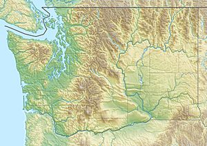
Location of the mouth of the Cedar River in Washington
|
|
| Country | United States |
| State | Washington |
| County | Pacific |
| Physical characteristics | |
| Main source | Willapa Hills 165 ft (50 m) 46°45′46″N 124°3′17″W / 46.76278°N 124.05472°W |
| River mouth | Willapa Bay Tokeland, Washington 0 ft (0 m) 46°44′10″N 123°58′30″W / 46.73611°N 123.97500°W |
| Length | 8 mi (13 km) |
The Cedar River is a small but important stream in the United States. It flows into the northern part of Willapa Bay in Washington. This river is only about 8 mi (13 km) long.
Contents
Where Does the Cedar River Start?
The Cedar River begins its journey in the Willapa Hills. This area is close to the Pacific Ocean. It starts near a place called Seastrand Ridge. This spot is just south of Grayland.
The River's Path
From its start, the river flows east. Then, it turns and flows south. It travels for about 8 mi (13 km). Finally, it empties into the northern end of Willapa Bay. This happens near the town of Tokeland.
Wildlife and Nature
The lower part of the Cedar River is very important for nature. It flows through a special area. This area is called the North Willapa Bay Wildlife Area Unit. It is also part of the Johns River Wildlife Area. These places help protect local animals.
The Cedar River Estuary
Where the Cedar River meets Willapa Bay, there is an estuary. An estuary is where fresh river water mixes with salty ocean water. This area is affected by the tides. It is a protected place called the Cedar River Estuary. It covers about 275 acres.
What is an Estuary?
The Cedar River Estuary is a unique ecosystem. It has different types of habitats. You can find salt marshes here. There are also tidelands, which are muddy areas covered by water at high tide. Plus, there are forests with tall evergreen trees. This estuary is home to many plants and animals. It also includes Oyster Island, Bone Creek, and Norris Slough.
 | Toni Morrison |
 | Barack Obama |
 | Martin Luther King Jr. |
 | Ralph Bunche |


