Cedar Run (Pennsylvania) facts for kids
Quick facts for kids Cedar Run |
|
|---|---|

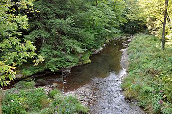
Downstream from bridge at Mine Hole Run
|
|
|
Location of the mouth of Cedar Run in Pennsylvania
|
|
| Country | United States |
| State | Pennsylvania |
| County | Tioga County, Lycoming County |
| Physical characteristics | |
| Main source | near Leetonia Tioga State Forest, Tioga County, Pennsylvania 2,138 ft (652 m) 41°39′05″N 77°32′08″W / 41.65139°N 77.53556°W |
| River mouth | Pine Creek Cedar Run (community), Lycoming County 784 ft (239 m) 41°31′40″N 77°26′48″W / 41.52778°N 77.44667°W |
| Length | 11.4 mi (18.3 km) |
Cedar Run is a stream in Pennsylvania, United States. It flows for about 11.4 miles (18.3 kilometers). This stream is a tributary, which means it's a smaller river or stream that flows into a larger one. Cedar Run flows into Pine Creek.
You can find Cedar Run in two counties: Lycoming County and Tioga County. It joins Pine Creek at a small community also called Cedar Run.
Cedar Run: A Pennsylvania Stream
Cedar Run is an important part of the natural landscape in central Pennsylvania. It's known for its clear waters and the beautiful areas it flows through. Many people enjoy visiting the region around Cedar Run for outdoor activities.
Where Does Cedar Run Start and End?
Every stream has a beginning and an end. Cedar Run starts high up in the mountains.
- Source: Cedar Run begins near a place called Leetonia. This area is part of the Tioga State Forest in Tioga County, Pennsylvania. The water here is about 2,138 feet (652 meters) above sea level.
- Mouth: The stream ends when it flows into Pine Creek. This happens near the community of Cedar Run in Lycoming County. At this point, the water is about 784 feet (239 meters) above sea level.
Its Journey Through Counties
Cedar Run travels through two different counties during its journey.
- It starts in Tioga County.
- Then, it flows into Lycoming County before joining Pine Creek.
 | Jessica Watkins |
 | Robert Henry Lawrence Jr. |
 | Mae Jemison |
 | Sian Proctor |
 | Guion Bluford |


