Cega (river) facts for kids
Quick facts for kids Cega |
|
|---|---|
 |
|
 |
|
| Country | Spain |
| Physical characteristics | |
| Main source | Sierra de Guadarrama Province of Segovia 41°0′55″N 3°51′4″W / 41.01528°N 3.85111°W |
| River mouth | Douro Province of Valladolid 41°32′57″N 4°46′3″W / 41.54917°N 4.76750°W |
| Length | 133 km (83 mi) |
| Basin features | |
| Progression | Douro→ Atlantic Ocean |
| River system | Douro |
| Tributaries |
|
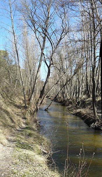
The Cega River is an important waterway in Spain. It flows into the Douro River. The Cega is a "left-bank tributary," meaning it joins the Douro from the left side.
Contents
Where the Cega River Starts
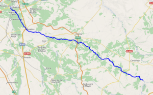
The Cega River begins in the Sierra de Guadarrama mountains. It forms when two smaller streams, the Artiñuelo and the Vueltas creeks, meet. This area is located in the Province of Segovia.
How Long is the Cega River?
The Cega River is about 133 kilometers (or 83 miles) long. It flows mostly towards the northwest.
Where the Cega River Flows
The river flows through the Province of Segovia. Then, it enters the Province of Valladolid. Along its journey, the Cega River receives water from other streams.
Main Tributary
The most important stream that joins the Cega River is the Pirón. The Pirón River adds its waters to the Cega from the left side.
Where the Cega River Ends
Finally, the Cega River empties into the Douro River. This happens in the Province of Valladolid. The Douro River is one of the largest rivers in the Iberian Peninsula.
See also
 In Spanish: Río Cega para niños
 | Aurelia Browder |
 | Nannie Helen Burroughs |
 | Michelle Alexander |

