
Chalatenango Department facts for kids
Quick facts for kids
Chalatenango
|
||
|---|---|---|
 |
||
|
||

Location within El Salvador
|
||
| Country | ||
| Created (given current status) |
1855 | |
| Seat | Chalatenango | |
| Area | ||
| • Total | 2,016.6 km2 (778.6 sq mi) | |
| Highest elevation | 2,730 m (8,960 ft) | |
| Population | ||
| • Total | 204,888 | |
| • Density | 101.6007/km2 (263.145/sq mi) | |
| Time zone | UTC−5 (CST) | |
| ISO 3166 code | SV-CH | |

Chalatenango is a special region, like a state or province, in the northwest part of El Salvador. Its main city, which is also its capital, is called Chalatenango. This area became an official department on February 14, 1855.
It's also home to El Pital, the highest mountain in all of El Salvador, standing tall at 2,730 meters (about 8,957 feet)!
Cities and Towns

El Pital mountain, a tall mountain in Chalatenango.
Chalatenango Department is made up of many smaller areas called municipalities. Each municipality has its own local government and often includes a main town and surrounding villages. Here are some of the municipalities you can find in Chalatenango:
- Agua Caliente
- Arcatao
- Azacualpa
- Chalatenango
- Citalá
- Comalapa
- Concepción Quezaltepeque
- Dulce Nombre de María
- El Carrizal
- El Paraíso
- La Laguna
- La Palma
- La Reina
- Las Vueltas
- Nombre de Jesús
- Nueva Concepción
- Nueva Trinidad
- Ojos de Agua
- Potonico
- San Antonio de la Cruz
- San Antonio Los Ranchos
- San Fernando
- San Francisco Lempa
- San Francisco Morazán
- San Ignacio
- San Isidro Labrador
- San José Cancasque
- San José Las Flores
- San Luis del Carmen
- San Miguel de Mercedes
- San Rafael
- Santa Rita
- Tejutla
Images for kids
-
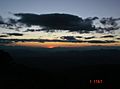
A beautiful sunset view in La Palma.

See also
 In Spanish: Departamento de Chalatenango para niños

All content from Kiddle encyclopedia articles (including the article images and facts) can be freely used under Attribution-ShareAlike license, unless stated otherwise. Cite this article:
Chalatenango Department Facts for Kids. Kiddle Encyclopedia.