Charity Creek facts for kids
Quick facts for kids Charity |
|
|---|---|
|
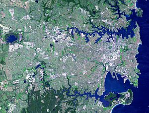
NASA satellite view of Greater Metropolitan Sydney, with the location of the mouth of the Charity Creek
|
|
| Country | Australia |
| State | New South Wales |
| Municipality | Sydney |
| Physical characteristics | |
| Main source | Denistone Park West Ryde 33°47′52.8″S 151°5′34.7994″E / 33.798000°S 151.092999833°E |
| River mouth | Parramatta River Meadowbank Park, Meadowbank 33°49′8.94″S 151°5′8.952″E / 33.8191500°S 151.08582000°E |
| Basin features | |
| River system | Parramatta River |
Charity Creek is a small waterway in Sydney, Australia. It is a northern tributary (a smaller stream that flows into a larger one) of the Parramatta River. You can find it west of Sydney Harbour. The creek joins the Parramatta River at Meadowbank Park in Meadowbank. It's an important part of the local environment.
Contents
Exploring Charity Creek's Environment
The Charity Creek starts in the suburb of West Ryde. The area that collects water for the creek, called its catchment, is about 237 hectares. That's like 237 football fields!
The creek's catchment area has clear boundaries. These include Victoria Road, Devlin Street, Blaxland Road, and Marlow Avenue. The Main North railway line also forms part of this boundary. The catchment mostly has homes, but there are some shops too. Most of the creek's water flows through underground pipes. However, there is a short section of natural open channel near Meadowbank Boys High School.
Charity Creek Cascades
The Charity Creek Cascades are a series of connected parks. They run from Top Ryde to the West Ryde railway station. These parks cover about 0.48 hectares. They stretch from Shepherd Street to Linton Lane. It's a nice green space for the community.
A Look Back at Charity Creek's History
Charity Point is a place near Charity Creek. It got its name from an early settler named William Bennet. He was a farmer and a trader who traveled to the South Sea islands. When his ships needed repairs, many of his South Sea Islander crew would camp on the shore. People say his kindness to them led to the names Charity Creek and Charity Headland.
Dinner Point Becomes Charity Point
Dinner Point, now known as Charity Point, is located at Meadowbank Memorial Park. It is believed to have gotten its first name on February 15, 1788. First Lieutenant William Bradley wrote about having dinner there. He then explored a very narrow creek nearby.
The local Aboriginal people originally called Charity Point Mur-ray-mah. This name might have meant 'black bream', a type of fish. It was also a popular spot for fishing. Later, in the 1840s, the farms and orchards in the Ryde area started to be divided up. This is when parts of Charity Creek were filled in.
 | Aaron Henry |
 | T. R. M. Howard |
 | Jesse Jackson |


