Charron Island facts for kids
|
Native name:
Île Charron
|
|
|---|---|

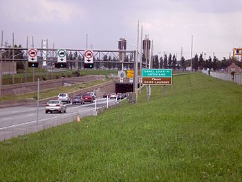
Montreal side of Lafontaine Tunnel, leading to Charron Island.
|
|
| Geography | |
| Location | Saint Lawrence River |
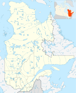
| Coordinates | 45°35′07″N 73°28′56″W / 45.585212°N 73.482335°W |
| Archipelago | Îles de Boucherville |
| Administration | |
|
Canada
|
|
| Demographics | |
| Population | 0 |
| Additional information | |
| Official website | gouverneur-ile-charron.com |
| Accessible by Quebec Autoroute 25 (exit 1) | |
Charron Island (in French, Île Charron) is an island located in the Saint Lawrence River. It's the most western island in the Îles de Boucherville group. This island is found near Montreal and is part of the Îles-de-Boucherville National Park. You can reach Charron Island by using the Louis-Hippolyte Lafontaine Bridge–Tunnel, which carries Quebec Autoroute 25 and the Trans-Canada Highway.
Contents
Exploring Charron Island's Past
Charron Island has a long and interesting history. It has changed names and owners many times over the centuries.
Early Days and Name Changes
In 1672, Louis XIV of France, who was the King of France, gave Charron Island to René Gaultier. At that time, the island was called "Île Notre-Dame." René Gaultier was the governor of a town called Trois-Rivières. He became the seigneur of Varennes, which meant he was like a lord or landlord of the area. The island was then connected to another land area called the fief Du Tremblay.
Later, in 1689, René Gaultier's wife gave the island to their daughter, Madeleine Le-Villier. Because of this, the island's name changed again, this time to Île Madeleine.
How the Island Got Its Name
From 1690 to 1753, the island was sold several times. First, it went to Louis Lamoureux. Three years later, Prudent Bougret dit Dufort bought it, and the island became known as Île Dufort.
Then, a man named François Charron married Marie-Joseph Lamoureux, who was Louis Lamoureux's daughter. François Charron inherited half of the island. The other half went to a religious group called the Jesuits.
In 1815, a surveyor named Joseph Bouchette drew a map and listed the island as Île Charron. However, this name didn't become official until 1950. Before that, people sometimes called it Île Dufort and sometimes Île Charron.
Connecting to the Mainland
A very important event for Charron Island happened on March 11, 1967. This was when the Louis-Hippolyte Lafontaine Bridge-Tunnel opened. This bridge-tunnel connected the island directly to the cities of Montreal and Longueuil. This meant the island was no longer isolated.
After the bridge-tunnel opened, a four-star hotel was built on the island. Charron Island also became the main way for people to get to the Îles de Boucherville group of islands. Building the bridge involved a lot of earthwork, which changed the shape of the island. Because of this, Charron Island and a nearby island called Sainte-Marguerite Island became almost like one big island.
Becoming a Park and Green Space
In 1984, the Îles-de-Boucherville National Park was created. This park includes most of the islands in the archipelago. Five years later, in 1989, the Government of Quebec bought the rest of Charron Island from the Society of Jesus for $30,000.
The government then gave the island to the city of Longueuil. The plan was to turn the island into a park and a green space for everyone to enjoy.
See also
 In Spanish: Isla Charron para niños
 | Jewel Prestage |
 | Ella Baker |
 | Fannie Lou Hamer |


