Cherry Run (Oil Creek tributary) facts for kids
Quick facts for kids Cherry Run |
|
|---|---|
|
Location of Cherry Run mouth
|
|
| Other name(s) | Tributary to Oil Creek |
| Country | United States |
| State | Pennsylvania |
| County | Venango |
| City | Rouseville |
| Physical characteristics | |
| Main source | on divide of Oil Creek and Pithole Creek about 0.5 miles southwest of East Shamburg, Pennsylvania 1,550 ft (470 m) 41°33′50″N 079°37′56″W / 41.56389°N 79.63222°W |
| River mouth | just west of Rouseville, Pennsylvania Rouseville, Pennsylvania 1,030 ft (310 m) 41°28′04″N 079°41′34″W / 41.46778°N 79.69278°W |
| Length | 9.9 mi (15.9 km) |
| Basin features | |
| Progression | south then southwest |
| River system | Allegheny River |
| Basin size | 12.8 square miles (33 km2) |
| Tributaries |
|
| Bridges | White City Road, Christie Hill Road (x2), PA 227 (x4), PA 8 |
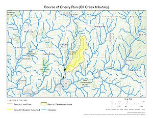
Cherry Run is a small stream located in Venango County, Pennsylvania, in the United States. It is about 4.4 miles (7.1 km) long. This stream is a tributary, which means it flows into a larger body of water. Cherry Run eventually joins Oil Creek.
Where Does Cherry Run Start?
Cherry Run begins in a hilly area of Venango County. Its starting point is on a "divide." A divide is like a natural ridge or high ground. It separates the areas where water flows into different streams or rivers.
The source of Cherry Run is about 0.5 miles southwest of a place called East Shamburg, Pennsylvania. At this point, the stream is quite high up, at an elevation of about 1,550 feet (472 meters) above sea level.
Cherry Run's Journey
From its source, Cherry Run flows generally south. Then, it turns and flows southwest. As it travels, the stream drops in elevation. This drop helps the water move along its path.
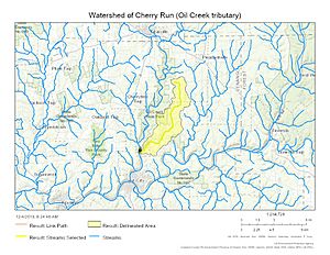
The area that drains into Cherry Run is called its watershed. This watershed covers about 12.8 square miles (33.2 square kilometers). Many smaller, unnamed streams also flow into Cherry Run along its journey.
Joining Oil Creek
Cherry Run's journey ends when it flows into Oil Creek. This meeting point is just west of Rouseville, Pennsylvania. At its mouth, where it joins Oil Creek, Cherry Run is at a lower elevation of about 1,030 feet (314 meters).
On average, about 22.94 cubic feet (0.65 cubic meters) of water flow from Cherry Run into Oil Creek every second. Oil Creek is a larger stream that eventually flows into the Allegheny River. This means Cherry Run is part of the larger Allegheny River system.
Bridges Along the Way
Even though Cherry Run is a smaller stream, several bridges cross over it. These bridges help people and vehicles travel across the water. Some of the roads that cross Cherry Run include:
- White City Road
- Christie Hill Road (it crosses twice!)
- Pennsylvania Route 227 (it crosses four times!)
- Pennsylvania Route 8
These bridges are important for connecting different parts of the community.
 | James Van Der Zee |
 | Alma Thomas |
 | Ellis Wilson |
 | Margaret Taylor-Burroughs |


