Chichihualco facts for kids
Quick facts for kids
Chichihualco
|
|
|---|---|
|
Municipal seat and city
|
|
| Country | |
| State | Guerrero |
| Municipality | Leonardo Bravo |
| Elevation | 1,141 m (3,743 ft) |
| Population
(2010)
|
|
| • Total | 10,690 |
| Time zone | UTC-6 (Zona Centro) |
Chichihualco is a city located in the southern part of Mexico. It serves as the main administrative center for the Leonardo Bravo municipality.
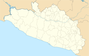
This city is found in the middle of the state of Guerrero. It is about 21 kilometers (about 13 miles) northwest of Chilpancingo, which is the capital city of Guerrero.
Contents
About Chichihualco
Where is Chichihualco?
Chichihualco is in the central part of the state of Guerrero, Mexico. It sits at an altitude of 1,141 meters (about 3,743 feet) above sea level. Its exact location is 17°39′28″ north latitude and 99°40′35″ west longitude.
How Many People Live There?
In 2010, Chichihualco had a total population of 10,690 people. This number comes from Mexico’s National Institute for Federalism and Municipal Development (INAFED).
What Does the Name Mean?
The name "Chichihualco" comes from the local Nahuatl language. It literally means ‘in the bosom’. This can be understood as ‘place where they suckle’ or ‘place of the wet nurses’.
A Bit of History
Chichihualco has a connection to Mexico's history. Some records suggest that Maria Fermina Rivera died here in February 1821. She was fighting alongside Vicente Guerrero, a very important leader in Mexico's fight for independence. However, other historical accounts might have different details about this event.
See also

- In Spanish: Chichihualco para niños
 | John T. Biggers |
 | Thomas Blackshear |
 | Mark Bradford |
 | Beverly Buchanan |


