Chulluncunayoc facts for kids
Quick facts for kids Chulluncunayoc |
|
|---|---|

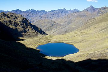
Chulluncunayoc (center-right, in the background) and Pucaorjo (on the right) as seen from Queuñacocha
|
|
| Highest point | |
| Elevation | 4,800 m (15,700 ft) |
| Naming | |
| Language of name | Quechua |
| Geography | |
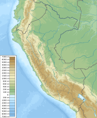
| Location | Peru, Cusco Region, Calca Province |
| Parent range | Andes |
Chulluncunayoc is a mountain in the amazing Andes mountain range in Peru. It stands tall at about 4,800 meters (that's about 15,748 feet) above sea level. Imagine climbing that high!
About Chulluncunayoc
Chulluncunayoc is a really interesting mountain. It's part of the huge Andes, which is the longest mountain range in the world. This mountain is known for its impressive height and the beautiful views around it.
Where is Chulluncunayoc?
This mountain is found in the Cusco Region of Peru. More specifically, it's in the Calca Province, within the Calca District. It sits to the east of the Urubamba mountain range.
Chulluncunayoc is located near other mountains too. You can find it northeast of Ccerayoc and Pachacútec. It's also southwest of a mountain called Yanacaca.
What's in a Name?
The name Chulluncunayoc comes from the Quechua language. Quechua is a language spoken by many people in the Andes. The name likely means something like "the place with icicles" or "where there is ice." This makes sense because mountains this high often have ice and snow, especially at their peaks.
The name Yanacaca also comes from Quechua. It probably means "black rock," which might describe the color of the rocks on that mountain.
See also
 In Spanish: Chulluncunayoc para niños
 | James Van Der Zee |
 | Alma Thomas |
 | Ellis Wilson |
 | Margaret Taylor-Burroughs |


