Churdan, Iowa facts for kids
Quick facts for kids
Churdan, Iowa
|
|
|---|---|
 |
|

Location of Churdan, Iowa
|
|
| Country | |
| State | |
| County | Greene |
| Area | |
| • Total | 2.07 sq mi (5.37 km2) |
| • Land | 2.07 sq mi (5.36 km2) |
| • Water | 0.00 sq mi (0.01 km2) |
| Elevation | 1,122 ft (342 m) |
| Population
(2020)
|
|
| • Total | 365 |
| • Density | 176.33/sq mi (68.09/km2) |
| Time zone | UTC-6 (Central (CST)) |
| • Summer (DST) | UTC-5 (CDT) |
| ZIP code |
50050
|
| Area code(s) | 515 |
| FIPS code | 19-13350 |
| GNIS feature ID | 2393523 |
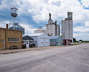
Churdan is a small city located in Greene County, Iowa, United States. In 2020, about 365 people lived there. It's a quiet place with a rich history and a strong community spirit.
Contents
History of Churdan
Churdan began in 1882. This was after a railroad line was built through the area. The city was named after Joseph Churdan. He was one of the first people to settle there. Joseph Churdan also became the village's first postmaster. Churdan officially became a town in 1884.
Geography of Churdan
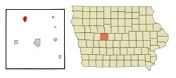
Churdan is located in Iowa. It covers a total area of about 2.11 square miles (5.37 square kilometers). All of this area is land. This means there are no large lakes or rivers within the city limits.
Population of Churdan
| Historical populations | ||
|---|---|---|
| Year | Pop. | ±% |
| 1890 | 377 | — |
| 1900 | 626 | +66.0% |
| 1910 | 667 | +6.5% |
| 1920 | 763 | +14.4% |
| 1930 | 616 | −19.3% |
| 1940 | 677 | +9.9% |
| 1950 | 593 | −12.4% |
| 1960 | 586 | −1.2% |
| 1970 | 598 | +2.0% |
| 1980 | 540 | −9.7% |
| 1990 | 423 | −21.7% |
| 2000 | 418 | −1.2% |
| 2010 | 386 | −7.7% |
| 2020 | 365 | −5.4% |
| Source: and Iowa Data Center Source: |
||
The population of Churdan has changed over the years. Here's a look at the people who call Churdan home.
Churdan in 2020
In 2020, the census counted 365 people living in Churdan. There were 162 households in the city. A household is a group of people living together. The city had about 176 people per square mile. Most people in Churdan were White (95.9%). Some people were Black or African American (1.4%). Others were from different backgrounds. About 2.2% of the population was Hispanic or Latino.
About 29% of households had children under 18. Many households were married couples. Some were single parents. Others were people living alone. The average age in Churdan was 40.1 years. About 27.4% of residents were under 20 years old. About 22.7% were 65 years or older.
Churdan in 2010
In 2010, the census recorded 386 people in Churdan. There were 177 households. The population density was about 183 people per square mile. Most residents were White (94.6%). There were also people from African American, Native American, and Asian backgrounds. About 0.8% of the population was Hispanic or Latino.
About 22.6% of households had children under 18. The average household had 2.18 people. The average age was 48.2 years. About 21.5% of residents were under 18. About 25.1% were 65 or older.
Economy of Churdan
Churdan works closely with the nearby community of Paton. Together, they offer various businesses. These cities also provide medical and other services for the surrounding area. This helps both communities thrive.
Education in Churdan
Students in Churdan attend the Paton-Churdan Community School. This public school serves students from kindergarten through twelfth grade. The school was created in 1962. This happened when the Paton and Churdan schools joined together. They formed the Paton-Churdan Community School District.
The school district is mostly a farming area. It is in northern Greene County. The main school building for all grades (K-12) is located in Churdan. The district covers about 125 square miles (324 square kilometers) of farmland. For some classes, high school students travel to Jefferson-Scranton High School. This allows them to take more advanced or different courses.
See also
 In Spanish: Churdan (Iowa) para niños
 | Kyle Baker |
 | Joseph Yoakum |
 | Laura Wheeler Waring |
 | Henry Ossawa Tanner |

