Cimanes de la Vega facts for kids
Quick facts for kids
Cimanes de la Vega
|
|||
|---|---|---|---|

Satellite view
|
|||
|
|||
| Country | Spain | ||
| Community | Castile and León | ||
| Province | León | ||
| Municipality | Cimanes de la Vega | ||
| Area | |||
| • Total | 26.04 km2 (10.05 sq mi) | ||
| Elevation | 720 m (2,360 ft) | ||
| Population
(2018)
|
|||
| • Total | 472 | ||
| • Density | 18.126/km2 (46.95/sq mi) | ||
| Demonym(s) | cimanés, cimanesa | ||
| Time zone | UTC+1 (CET) | ||
| • Summer (DST) | UTC+2 (CEST) | ||
| Postal Code |
24239
|
||
| Telephone prefix | 987 | ||
| Climate | Csb | ||
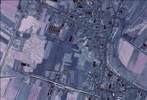
Cimanes de la Vega is a small town in northern Spain. It is located in the province of León, which is part of the Castile and León region. This town is the most southerly municipality (a type of local government area) in the province.
You can find Cimanes de la Vega near the N-620 highway, which connects the cities of León and Benavente. It is also very close to the Esla River.
Contents
Life in Cimanes de la Vega
Population and Villages
Cimanes de la Vega is home to about 570 people. These people live in three main villages. The villages are Cimanes de la Vega itself, Bariones de la Vega, and Lordemanos.
Main Activities and Farming
The main activity in Cimanes de la Vega is agriculture. This means that most people work with farming. The land in this area can be quite dry. Because of this, irrigation is very important. Irrigation is when farmers bring water to their fields using channels or pipes.
The main crops grown here are beet (a root vegetable), maize (also known as corn), and plants used to feed farm animals.
What to See in Cimanes de la Vega
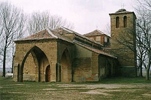
One important place to visit in Cimanes de la Vega is the "Virgen de la Vega". This is an old hermitage, which is a small church or chapel. It was built a very long time ago, in the 11th century.
See also
 In Spanish: Cimanes de la Vega para niños


