
Civil parishes in Cornwall facts for kids
.svg)
A civil parish is the smallest type of local government area in England. Think of it like a small community or neighborhood with its own local council. In Cornwall, there are 218 civil parishes, including the Isles of Scilly. Almost all of Cornwall is divided into these parishes. Only a tiny, unpopulated rock called Wolf Rock is not part of a parish.
Back in 2001, about 501,267 people lived in these parishes, which was the entire population of Cornwall at the time. The last parts of mainland Cornwall that weren't parishes, especially around St Austell, became parishes on April 1, 2009. This change happened when local government in England was updated.
The size of these parishes can be very different. For example, Falmouth is the biggest with 26,767 people living there in 2011. On the other hand, St Michael's Mount had only 29 residents. Cornwall is managed by two main local authorities. Cornwall Council looks after mainland Cornwall, while the Isles of Scilly have their own separate authority.
How Parishes Started
Parishes first began as areas managed by the Church of England. Over time, they started taking on jobs for the local community, not just for the church.
In 1555, a law called the Highways Act 1555 made parishes responsible for keeping roads in good condition. Everyone in the parish had to work on the roads for four days a year, bringing their own tools and horses. An unpaid local person, called the Surveyor of Highways, was in charge of this work.
Before the 1500s, monasteries helped look after people who were poor. After the monasteries were closed down, new laws were made. In 1572, local leaders called magistrates were given the power to check on the poor and collect taxes to help them. This system became more official with the Poor Law Act of 1601. This law made parishes responsible for managing help for the poor. People called overseers were chosen to collect a special tax, called a rate, to support the poor in their parish.
During the 1800s, parishes gained more responsibilities. However, the power to help the poor was moved to larger groups called Poor Law Unions. In 1872, the Public Health Act grouped parishes into Rural Sanitary Districts. These districts later became the basis for rural districts, which were larger local areas.
Parishes used to be run by groups called vestries. These groups met once a year to choose local officials. Usually, these civil parishes were the same as the church parishes. However, some larger areas, called townships, managed their own poor relief. In 1882, a law made all special areas and townships that collected their own taxes into independent civil parishes.
The civil parishes we know today really started with the Local Government Act 1894. This law got rid of the old vestries. It created elected parish councils in all rural parishes that had more than 300 voters. It also grouped rural parishes into Rural Districts and made sure parish borders matched county and town borders. Civil parishes also existed in towns, usually covering the same area as the town itself. Many big towns had several parishes, which were often combined into one. Town areas didn't have parish councils, and the only job of the parish was to choose guardians for the Poor Law Unions. When the Poor Law system ended in 1930, these town parishes had very little to do.
The Local Government Act 1972 kept civil parishes in rural areas. Many old town districts and boroughs that were being closed down were replaced by new parishes. Larger town areas that were too big to be a single parish became unparished areas, meaning they didn't have a parish council.
Parishes Today
In recent years, governments have encouraged new town and parish councils to form in areas that didn't have them. The Local Government and Rating Act 1997 gave local people the right to ask for a new civil parish to be created.
A parish council can decide to call itself a town council whenever it wants. A civil parish can also become a city, but only if the King or Queen grants it this special status. The leader of a town or city council is called a mayor. In 2007, a new law allowed parish councils to choose other names, such as community, village, or neighborhood council.
In Cornwall, the 2007 law led to big changes. Six smaller district councils and the Cornwall County Council were removed. In their place, one large local authority, Cornwall Council, was created. All civil parish councils then became part of this new authority. At the same time, four new civil parishes were created in the St Austell area. This meant that the last populated part of Cornwall that didn't have a parish now had one.
Images for kids
-
Advent
-
Altarnun
-
Antony
-
Blisland
-
Boconnoc
-
Bodmin
-
Botusfleming
-
Boyton
-
Breage
-
Braddock
-
Bryher
-
Bude–Stratton
-
Budock
-
Callington
-
Calstock
-
Camborne
-
Camelford
-
Cardinham
-
Carharrack
-

Carlyon
-
Carn Brea
-
Chacewater
-
Colan
-
Constantine
-
Crantock
-
Crowan
-
Cubert
-
Cury
-
Davidstow
-
Delabole
-
Deviock
-
Dobwalls
-
Duloe
-
Egloshayle
-
Egloskerry
-
Falmouth
-

Feock
-
Forrabury and Minster
-
Fowey
-
Germoe
-
Gerrans
-
Grade–Ruan
-
Grampound with Creed
-
Gunwalloe
-
Gweek
-
Gwennap
-
Gwinear–Gwithian
-
Hayle
-
Helland
-
Helston
-
Illogan
-
Jacobstow
-
Kea
-
Kenwyn
-
Kilkhampton
-
Ladock
-
Landewednack
-

Landrake with St Erney
-
Landulph
-
Laneast
-
Lanhydrock
-
Lanivet
-
Lanlivery
-
Lanner
-
Lanreath
-
Lanteglos
-
Launcells
-
Launceston
-
Lawhitton Rural
-
Lesnewth
-
Lewannick
-
Lezant
-
Linkinhorne
-
Liskeard
-
Looe
-
Lostwithiel
-
Ludgvan
-

Luxulyan
-
Mabe
-
Madron
-
Maker-with-Rame
-
Manaccan
-
Marazion
-
Marhamchurch
-
Mawgan-in-Meneage
-
Mawgan-in-Pydar
-
Mawnan
-
Menheniot
-
Mevagissey
-
Michaelstow
-
Millbrook
-
Morvah
-
Morval
-
Morwenstow
-
Mullion
-
Mylor
-
Newquay
-
North Hill
-

North Petherwin
-
North Tamerton
-
Otterham
-
Padstow
-
Pelynt
-
Penryn
-
Pentewan Valley
-
Penzance
-
Perranarworthal
-
Perranuthnoe
-
Perranzabuloe
-
Philleigh
-
Pillaton
-
Polperro
-
Ponsanooth
-
Porthleven
-
Portreath
-
Poundstock
-
Probus
-
Quethiock
-
Redruth
-
Roche
-
Ruanlanihorne
-
Saltash
-
Sancreed
-
Sennen
-
Sheviock
-

Sithney
-
South Hill
-
South Petherwin
-
St Agnes
-

St Agnes, Isles of Scilly
-
St Allen
-

St Anthony-in-Meneage
-
St Austell
-
St Austell Bay
-

St Blaise
-
St Breock
-
St Breward
-
St Buryan, Lamorna and Paul
-
St Cleer
-

St Clement
-
St Clether
-
St Columb Major
-
St Day
-
St Dennis
-
St Dominick
-
St Endellion
-
St Enoder
-
St Erme
-
St Erth
-
St Ervan
-
St Eval
-

St Ewe
-
St Gennys
-
St Germans
-
St Goran
-
St Hilary
-
St Issey
-
St Ive and Pensilva
-
St Ives
-
St John
-
St Juliot
-
St Just
-
St Just in Roseland
-
St Keverne
-
St Kew
-
St Keyne and Trewidland
-
St Levan
-
St Martin-by-Looe
-
St Martin-in-Meneage
-
St Martin's, Isles of Scilly
-
St Mary's, Isles of Scilly
-
St Mellion
-
St Merryn
-
St Mewan
-
St Michael Caerhays
-
St Michael Penkevil
-
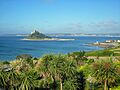
St Michael's Mount
-
St Minver Highlands
-
St Minver Lowlands
-
St Neot
-
St Newlyn East
-
St Pinnock
-
St Sampson
-
St Stephen-in-Brannel
-
St Stephens by Launceston Rural
-
St Teath
-
St Thomas the Apostle Rural
-
St Tudy
-
St Veep
-
St Wenn
-
St Winnow
-

Stithians
-
Stokeclimsland
-
Tintagel
-
Torpoint
-
Towednack
-
Tregony with Cuby
-
Tremaine
-
Treneglos
-
Tresco
-
Tresmeer
-
Trevalga
-
Treverbyn
-
Trewen
-
Truro
-
Tywardreath and Par
-
Veryan
-
Wadebridge
-
Warbstow
-
Warleggan
-
Week St Mary
-
Wendron
-
Werrington
-
Whitstone
-
Withiel
-
Wolf Rock
-
Zennor


_Castle_-_geograph.org.uk_-_407228.jpg)


_-_geograph.org.uk_-_529723.jpg)


_-_geograph.org.uk_-_56436.jpg)


See also
- List of civil parishes in England
- List of places in Cornwall
