Clatsop Butte facts for kids
Quick facts for kids Clatsop Butte |
|
|---|---|

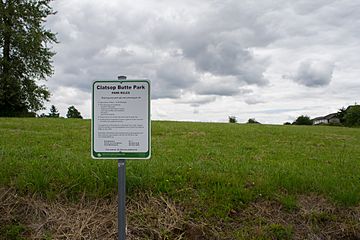
Clatsop Butte from SE 152nd Avenue at Evergreen
|
|
| Highest point | |
| Elevation | 577 ft (176 m) |
| Geography | |
| Geology | |
| Mountain type | Butte |
Clatsop Butte is a cool natural spot in southeast Portland, Oregon, United States. It's like a small, rounded hill, and it sits just south of another place called Powell Butte. Part of Clatsop Butte is a city park, which is a great place for nature lovers.
Contents
Exploring Clatsop Butte
Clatsop Butte is an upland butte. This means it's a raised area of land, like a small mountain or hill. It's located in the southeast part of Portland, Oregon. You can find it directly south of Powell Butte.
Where is Clatsop Butte Located?
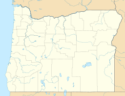
Clatsop Butte City Park is part of this natural area. It's located at coordinates 45°28′28″N 122°30′24″W / 45.47444°N 122.50667°W. The park's highest point is about 577 feet (176 m) above sea level.
A small river called Johnson Creek flows nearby. Also, Southeast Foster Road and the Springwater Corridor Trail pass between Clatsop Butte and Powell Butte. This area is near Southeast 152nd Avenue.
How Clatsop Butte Became a Park
The City of Portland started buying land on Clatsop Butte for a park in 2000. They first bought about 16 acres (6.5 ha). Over the next few years, they bought more land. By 2007, the park grew to about 102 acres (0.41 km2)!
There were some discussions about how the money was spent on these land purchases. In 2008, a group of 16 people was formed. Their job was to check if the money was used wisely for the park.
Wildlife and Nature at Clatsop Butte
As of 2008, a regional government group called Metro listed about 49 acres (20 ha) of Clatsop Butte as a protected natural area. This means it's a special place for plants and animals.
The natural area has lots of trees and hillsides. It also has parts of the creek flowing through it. Many different kinds of wildlife live here, including:
- Deer
- Foxes
- Coyotes
- Birds like northern flickers and pileated woodpeckers
- Other local and migratory birds that fly through the area
It's a great example of how cities can protect natural spaces for everyone to enjoy.
 | Bayard Rustin |
 | Jeannette Carter |
 | Jeremiah A. Brown |


