Clay Springs, Arizona facts for kids
Quick facts for kids
Clay Springs, Arizona
|
|
|---|---|
|
Census-designated place (CDP)
|
|
 |
|

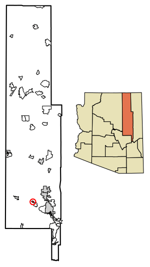
Location of Clay Springs in Navajo County, Arizona.
|
|
| Country | |
| State | |
| County | Navajo |
| Area | |
| • Total | 2.85 sq mi (7.37 km2) |
| • Land | 2.85 sq mi (7.37 km2) |
| • Water | 0.00 sq mi (0.00 km2) |
| Elevation | 6,306 ft (1,922 m) |
| Population
(2020)
|
|
| • Total | 331 |
| • Density | 116.30/sq mi (44.90/km2) |
| Time zone | UTC-7 (Mountain (MST)) |
| ZIP code |
85923
|
| Area code(s) | 928 |
| FIPS code | 04-00 |
| GNIS ID(s) | 2582759 |
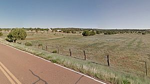
Clay Springs is a small community in Navajo County, Arizona, United States. It's known as a census-designated place (CDP). This means it's an area that looks like a town but isn't officially governed as one. Clay Springs is about 16 miles (26 km) northwest of Show Low. It has its own post office with the ZIP code 85923.
Contents
Who Lives in Clay Springs?
| Historical population | |||
|---|---|---|---|
| Census | Pop. | %± | |
| 2020 | 331 | — | |
| U.S. Decennial Census | |||
In 2010, there were 401 people living in Clay Springs. These people lived in 124 different homes. About 91 of these were families. The most recent count in 2020 showed that 331 people live there.
What's the Weather Like in Clay Springs?
Clay Springs has a special kind of weather called a cool-summer Mediterranean climate. This means the summers are warm but not too hot. The winters are quite cold, especially at night.
Winter Weather
During winter, nights can get very cold. On average, there are about 3.7 nights each year when the temperature drops below 0°F (about -18°C). There are also about 171 nights when it's below freezing (32°F or 0°C). Days in winter are usually cool to cold.
Spring and Summer Weather
From April to June, the weather starts to warm up. This time of year is usually the driest. Then, from July to mid-September, the area gets "monsoon storms." These are heavy rainstorms that bring much-needed water.
Even in summer, because Clay Springs is high up, the nights usually stay cool. The temperature rarely goes above 68°F (20°C) at night. About 17 days a year will reach 90°F (32°C) or higher.
| Climate data for Clay Springs, Arizona (1971-1987) | |||||||||||||
|---|---|---|---|---|---|---|---|---|---|---|---|---|---|
| Month | Jan | Feb | Mar | Apr | May | Jun | Jul | Aug | Sep | Oct | Nov | Dec | Year |
| Record high °F (°C) | 68 (20) |
72 (22) |
74 (23) |
82 (28) |
90 (32) |
100 (38) |
97 (36) |
95 (35) |
90 (32) |
89 (32) |
78 (26) |
68 (20) |
100 (38) |
| Mean daily maximum °F (°C) | 45.3 (7.4) |
50.0 (10.0) |
54.9 (12.7) |
64.2 (17.9) |
72.2 (22.3) |
83.7 (28.7) |
86.3 (30.2) |
83.4 (28.6) |
77.2 (25.1) |
67.3 (19.6) |
55.2 (12.9) |
47.7 (8.7) |
65.6 (18.7) |
| Mean daily minimum °F (°C) | 18.7 (−7.4) |
20.8 (−6.2) |
26.4 (−3.1) |
30.5 (−0.8) |
37.1 (2.8) |
47.3 (8.5) |
54.5 (12.5) |
54.1 (12.3) |
46.1 (7.8) |
35.4 (1.9) |
25.7 (−3.5) |
19.1 (−7.2) |
34.6 (1.4) |
| Record low °F (°C) | −17 (−27) |
−15 (−26) |
−2 (−19) |
11 (−12) |
13 (−11) |
28 (−2) |
34 (1) |
40 (4) |
26 (−3) |
10 (−12) |
−21 (−29) |
−22 (−30) |
−22 (−30) |
| Average precipitation inches (mm) | 1.33 (34) |
1.35 (34) |
1.91 (49) |
0.58 (15) |
0.94 (24) |
0.31 (7.9) |
2.30 (58) |
2.33 (59) |
2.07 (53) |
1.61 (41) |
1.65 (42) |
1.47 (37) |
17.85 (453.9) |
| Average precipitation days (≥ 0.01 inch) | 6 | 5 | 8 | 4 | 4 | 2 | 9 | 9 | 6 | 4 | 5 | 5 | 67 |
| Source: Western Regional Climate Center | |||||||||||||
How to Get Around Clay Springs
If you need to travel to or from Clay Springs, there's a service called Mountain Valley Shuttle. It makes stops in Clay Springs as part of its route between Phoenix and Show Low.
Images for kids
See also
 In Spanish: Clay Springs (Arizona) para niños


