Cleggan Bay facts for kids
Quick facts for kids Cleggan Bay |
|
|---|---|

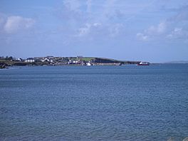
Cleggan Bay, looking towards Cleggan
|
|
| Location | County Galway |
| Coordinates | 53°33′50″N 10°7′00″W / 53.56389°N 10.11667°W |
| Ocean/sea sources | Atlantic Ocean |
| Basin countries | Ireland |
| Settlements | Cleggan |
Cleggan Bay (called Cuan na Cloigeann in Irish) is a beautiful natural bay in County Galway, Ireland. A bay is a part of the ocean that curves inward, with land on three sides. It is a calm and sheltered spot, perfect for boats and wildlife.
Where is Cleggan Bay?
Cleggan Bay is located between two pieces of land. To the north is Cleggan Head. To the south is Rossadilsk strand, which is part of the Aughrus Peninsula. If you look out to the west, you can see the islands of Inishbofin and Inishark in the ocean.
A Look at History
Cleggan Bay has a long and interesting history! Near the bay, you can find very old monuments from prehistoric times. These include ancient tombs, tall standing stones, and old walls. One famous monument is the Cleggan Court tomb, which is on the north side of the bay.
In October 1927, a very sad event happened here, known as the Cleggan Bay Disaster. A big storm hit the bay, and 26 local fishermen lost their lives. Many families in the area were affected. A nearby village lost so many people that it was later abandoned. This disaster is still remembered today through stories, poems, and special stone markers.
Getting Around Cleggan Bay
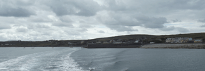
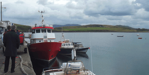
You can reach Cleggan by taking the R379 road. From the Cleggan pier, which was built a long time ago in 1822, ferries leave every day. These ferries take people to Inishbofin and also to Inishturk island.
Exploring the Area
If you love walking, there's a great path called the Cleggan Head walk on the north side of the bay. This walk lets you explore the beautiful area, even crossing some private land. Cleggan Bay is also part of the famous Wild Atlantic Way. This is a long coastal route that stretches from Mayo to Clare, offering amazing views of the Atlantic Ocean.


