Cleveland, Taylor County, Wisconsin facts for kids
Quick facts for kids
Cleveland, Wisconsin
|
|
|---|---|

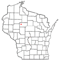
Location of Cleveland, Taylor County, Wisconsin
|
|
| Country | |
| State | |
| County | Taylor |
| Area | |
| • Total | 35.7 sq mi (92.4 km2) |
| • Land | 33.9 sq mi (87.7 km2) |
| • Water | 1.8 sq mi (4.7 km2) |
| Elevation | 1,280 ft (390 m) |
| Population
(2000)
|
|
| • Total | 262 |
| • Density | 7.7/sq mi (3.0/km2) |
| Time zone | UTC-6 (Central (CST)) |
| • Summer (DST) | UTC-5 (CDT) |
| Area code(s) | 715 & 534 |
| FIPS code | 55-15450 |
| GNIS feature ID | 1582978 |
| PLSS township | T32N R3W |
Cleveland is a small town in Taylor County, Wisconsin, in the United States. In 2000, about 262 people lived there. A smaller community called Hannibal is also part of the town.
Contents
Where is Cleveland Located?
Cleveland covers an area of about 35.7 square miles (92.4 square kilometers). Most of this area, about 33.9 square miles (87.7 square kilometers), is land. The rest, 1.8 square miles (4.7 square kilometers), is water.
Most of the water in Cleveland is part of a lake called Chequamegon Waters. It's also known as Miller Dam. This lake was made by people and is in the southeastern part of the town.
A Look Back at Cleveland's History
How Cleveland Was First Mapped
The area that is now Cleveland was first mapped out in 1847 by a team working for the U.S. government. In 1854, another team marked all the important corners in the area. They walked through forests and swamps, using chains and compasses to measure everything.
After their work, the surveyor described the land. He noted that the area had several swamps. He also said that some low-lying areas with meadows and Alder trees would often flood. These areas were good for making hay.
The land was generally low and flat, but some higher ground had good soil. The area was heavily covered with trees like Hemlock, Yellow Birch, White Pine, and Balsam. The undergrowth was thick with hemlock, Hazel, and balsam.
The Yellow River flowed through the area with a fast current. It was about 1 to 3 feet deep when the water was low. This river was good for powering mills. At that time, there were no buildings or improvements in the township.
Early Logging and Railroads
Logging began in the eastern part of Cleveland by the early 1860s. George Judson built a dam on the Yellow River near Hughey. He also started a logging camp nearby to cut down pine trees.
In 1903, two railway lines were built. The Stanley, Merrill and Phillips Railway built its line along the west side of the town. The Eau Claire, Chippewa Falls, and Northeastern Railway (also called Omaha) built its line across the town. It went from Hannibal east to Hughey on the Yellow River. Logs were floated down the Yellow River and then loaded onto trains at Hughey to be shipped out. The community of Hannibal grew where these two railway lines met.
Cleveland in the Early 1900s
A map from 1911 shows the two railroads in place. Hannibal was just north of where they joined. Some roads followed the paths of today's County M and Highway 73. The map showed five families living near Hannibal. Most of the rest of the township was owned by lumber companies. The Northwestern Lumber Company owned the most land. At this time, Chequamegon Waters did not exist; only the Yellow River flowed through that area.
Natural Areas Today
In 1933, much of the eastern part of Cleveland, which had been logged, became part of the Chequamegon National Forest. Bear Creek Hemlocks is a special natural area in the northeast corner of Cleveland. It has two stands of very old hemlock trees.
Part of the Pershing Wildlife Area covers a thousand acres in the northwest part of the town. The rest of Cleveland is privately owned. This land is mostly used for farms, homes, and wild areas.
Who Lives in Cleveland?
Based on the census from 2000, there were 262 people living in Cleveland. These people made up 98 households, and 72 of those were families. The population density was about 7.7 people per square mile (3.0 people per square kilometer).
All the people living in Cleveland at that time were White.
Out of the 98 households, about 32.7% had children under 18 living with them. Most households (67.3%) were married couples living together. About 23.5% of all households were made up of single individuals. About 11.2% of households had someone aged 65 or older living alone. The average household had about 2.67 people.
The population was spread out by age. About 30.2% were under 18 years old. About 26.3% were between 25 and 44 years old. And 16.8% were 65 years or older. The average age in the town was 39 years.
The average income for a household in Cleveland was $35,625. For families, the average income was $39,375. About 10.9% of all people in Cleveland lived below the poverty line. This included 13.6% of those under 18 and 8.0% of those 65 or older.
See also
 In Spanish: Cleveland (condado de Taylor, Wisconsin) para niños
 | Charles R. Drew |
 | Benjamin Banneker |
 | Jane C. Wright |
 | Roger Arliner Young |

