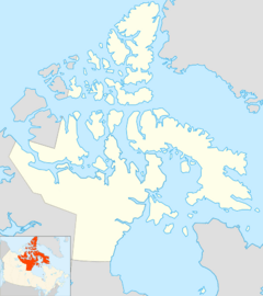
Clyde River (Baffin Island) facts for kids
Quick facts for kids Clyde River |
|
|---|---|
|
Mouth location
|
|
| Country | Canada |
| Territory | Nunavut |
| Island | Baffin Island |
| Physical characteristics | |
| Main source | Generator Lake 373 m (1,224 ft) |
| River mouth | Clyde Inlet 0 m (0 ft) 69°51′10″N 70°25′15″W / 69.85278°N 70.42083°W |
The Clyde River is an important waterway located on the eastern coast of Baffin Island in Nunavut, Canada. This river flows through a beautiful and remote part of the Canadian Arctic. It is a key feature of the Qikiqtaaluk Region, which is known for its stunning landscapes and unique wildlife.
Exploring the Clyde River
The Clyde River starts its journey from Generator Lake. This lake is found at the southeastern edge of the Barnes Ice Cap, which is a large ice sheet in the Baffin Mountains. Imagine a river born from melting ice!
Where the River Flows
From Generator Lake, the Clyde River flows generally towards the northeast. Its path takes it through rugged and icy terrain. Finally, the river reaches the head of Clyde Fiord. This fiord is a long, narrow inlet of the sea, located in a place called Kangiqtugaapik. The river's waters then join the larger Baffin Bay.
Nearby Communities
The closest community to the Clyde River is also named Clyde River. This settlement is about 100 kilometres (62 mi) (or 62 miles) to the northeast of where the river meets the sea. This area is home to many Inuit people, who have lived in the Arctic for thousands of years. They have a deep connection to the land and its waterways.
 | Emma Amos |
 | Edward Mitchell Bannister |
 | Larry D. Alexander |
 | Ernie Barnes |


