Kangiqtugaapik facts for kids
Quick facts for kids Kangiqtugaapik |
|
|---|---|

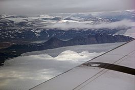
View of Kangiqtugaapik
|
|
| Location | Baffin Island |
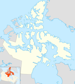
| Coordinates | 70°14′37″N 68°57′37″W / 70.24361°N 68.96028°W |
| Ocean/sea sources | Baffin Bay |
| Basin countries | Nunavut, Canada |
| Max. length | 120 km (75 mi) |
| Max. width | 16 km (9.9 mi) |
| Settlements | Clyde River |
Kangiqtugaapik (which means ᑲᖏᖅᑐᒑᐱᒃ in Inuktitut syllabics) is a large body of water located in eastern Baffin Island, Nunavut, Canada. It used to be called Clyde Inlet. This inlet opens into the Davis Strait from the west, connecting it to the wider ocean.
The Inuit community of Clyde River is found on Patricia Bay, which is part of Kangiqtugaapik. This area is a popular starting point for exciting adventures, especially for people who want to climb huge, remote rock walls on the east coast of Baffin Island. The nearby fjords have many tall granite cliffs, perfect for climbing.
Exploring Kangiqtugaapik's Geography
Kangiqtugaapik is a special type of inlet called a fjord. A fjord is a long, narrow, deep inlet of the sea, usually with steep sides, created by glaciers. Long ago, before the ice melted (a process called deglaciation), Kangiqtugaapik was a very long fjord, stretching about 120 kilometers (75 miles).
The Kangiqtugaapik system has three main parts:
- Patricia Bay: This bay is about 12 kilometers (7.5 miles) long. It is located near the northern entrance of Kangiqtugaapik. The community of Clyde River is found here.
- Two Long Fjords: About 20 kilometers (12 miles) from the mouth of the bay, the inlet splits into two long fjords. These branches stretch inland towards the southwest.
The Northern Branch: Kangiqtugaapik Fjord
The northern branch of this water system is also called Kangiqtugaapik. This part of the fjord is about 95 kilometers (59 miles) long. The Clyde River flows into the very end of this northern fjord.
The Southern Branch: Inugsuin Fiord
To the south, the other main branch is called the Inugsuin Fiord. It is about 90 kilometers (56 miles) long. At its entrance, Inugsuin Fiord has several small, unnamed islands.
 | Chris Smalls |
 | Fred Hampton |
 | Ralph Abernathy |


