Coaling, Alabama facts for kids
Quick facts for kids
Town of Coaling
|
|
|---|---|

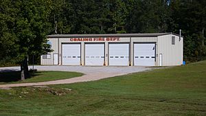
The Fire Department Building in Coaling, Alabama
|
|

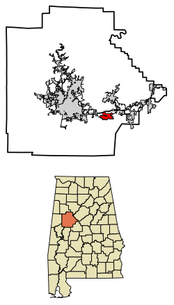
Location of Coaling in Tuscaloosa County, Alabama.
|
|
| Country | United States |
| State | Alabama |
| County | Tuscaloosa |
| Government | |
| • Type | Mayor/City Council From |
| Area | |
| • Total | 5.08 sq mi (13.16 km2) |
| • Land | 5.01 sq mi (12.98 km2) |
| • Water | 0.07 sq mi (0.18 km2) |
| Elevation | 407 ft (124 m) |
| Population
(2020)
|
|
| • Total | 2,035 |
| • Density | 405.94/sq mi (156.74/km2) |
| Time zone | UTC-6 (Central (CST)) |
| • Summer (DST) | UTC-5 (CDT) |
| ZIP code |
35449, 35453
|
| Area code(s) | 205, 659 |
| FIPS code | 01-16000 |
| GNIS feature ID | 0116314 |
Coaling is a town located in Tuscaloosa County, Alabama, in the United States. It became an official town in September 1997. According to the 2020 census, about 2,035 people live there. Coaling is part of the larger Tuscaloosa, Alabama area.
History of Coaling
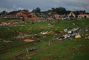
On April 27, 2011, a very strong tornado hit parts of Coaling. This tornado was rated as an EF-3, meaning it caused serious damage. It struck around 5:15 in the morning.
The storm completely destroyed three homes. At least ten other homes were badly damaged, and many more had lighter damage. Luckily, no one died, but some people were hurt and needed to go to the hospital.
Geography of Coaling
Coaling is located at 33°10′10″N 87°20′45″W / 33.16944°N 87.34583°W.
The U.S. Census Bureau states that the town covers a total area of about 3.7 square miles (9.6 square kilometers). Most of this area is land, with a small part, about 0.1 square miles (0.26 square kilometers), being water.
Population and People
| Historical population | |||
|---|---|---|---|
| Census | Pop. | %± | |
| 1880 | 190 | — | |
| 2000 | 1,115 | — | |
| 2010 | 1,657 | 48.6% | |
| 2020 | 2,035 | 22.8% | |
| U.S. Decennial Census 2013 Estimate |
|||
Coaling first appeared on the U.S. Census in 1880 as "Coaling Station." After that, it wasn't listed separately until 2000, which was after it officially became a town in 1997.
In 2010, there were 1,657 people living in Coaling. The population density was about 303.6 people per square mile (117.2 people per square kilometer).
Most of the people in Coaling are White (86.42%). About 11.40% are Black or African American. A small number of people are from other racial backgrounds, including Native American or two or more races. About 1.68% of the population identified as Hispanic or Latino.
The average age of people living in Coaling in 2010 was 35 years old.
See also
 In Spanish: Coaling para niños
 | Janet Taylor Pickett |
 | Synthia Saint James |
 | Howardena Pindell |
 | Faith Ringgold |


