Coco River facts for kids
Quick facts for kids Wangki River |
|
|---|---|
 |
|
|
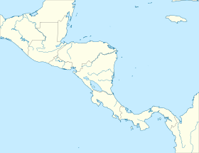
Location of the mouth
|
|
| Other name(s) | Río Segovia, Cape River, Yara River |
| Countries | Nicaragua and Honduras |
| Physical characteristics | |
| Main source | Somoto Canyon, Madriz Department, Nicaragua 2,219 ft (676 m) 13°27′06″N 86°42′32″W / 13.45167°N 86.70889°W |
| River mouth | Caribbean Sea Nicaragua 0 ft (0 m) 15°00′N 83°08′W / 15.000°N 83.133°W |
| Length | 841 km (523 mi) |
| Depth |
|
| Basin features | |
| Basin size | 27,000 km2 (10,000 sq mi) |
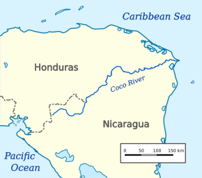
The Wangki River, also known as the Río Coco in Spanish, is a very important river in Central America. It forms a natural border between the countries of Nicaragua and Honduras. This river is special because it's the longest river that flows entirely within the Central American area. It stretches for about 841 kilometers (523 miles)!
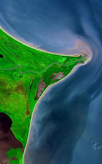
The river starts its journey in the beautiful Somoto Canyon National Monument in Nicaragua. From there, it flows through mountains and lowlands. Finally, it empties into the Caribbean Sea at a place called Cabo Gracias a Dios. For a large part of its path, the river acts as the official border between Honduras and Nicaragua.
In September 2007, after a very strong storm called Hurricane Felix, the Wangki River rose more than 11 meters (36 feet) above its normal level. This shows how powerful nature can be!
Contents
What is the Wangki River?
The Wangki River has a few different names. People in the Miskitu language call it Wangki. In Spanish, it's known as Río Coco. In the past, it was also called the Río Segovia, Cape River, or Yara River. No matter the name, it's a vital waterway for the region.
Where Does the River Start and End?
The Wangki River begins in the Somoto Canyon National Monument. This is a stunning natural area in Nicaragua, close to where the main highway crosses into the country. The river's starting point is quite high up, at about 2,219 feet (676 meters) above sea level.
From its source, the river flows eastward. It travels through many different landscapes, including some low mountains. After its long journey of 841 kilometers, it reaches the Caribbean Sea. The place where it meets the sea is called Cabo Gracias a Dios, which means "Cape Thanks to God." At this point, the river is at sea level.
The River as a Border
A big part of the Wangki River's importance comes from its role as a border. For much of its middle and lower sections, the river marks the line between Nicaragua and Honduras. This makes it a significant geographical feature for both countries. It helps define their territories and has played a role in their history.
See also
- Honduras–Nicaragua border
- List of rivers of the Americas
 In Spanish: Río Coco para niños
 | Anna J. Cooper |
 | Mary McLeod Bethune |
 | Lillie Mae Bradford |


