Coe Glacier facts for kids
Quick facts for kids Coe Glacier |
|
|---|---|
| Type | Mountain glacier |
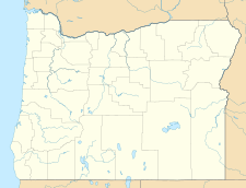
| Location | Cascade Range, Hood River County, Oregon, U.S. |
| Coordinates | 45°23′00″N 121°41′40″W / 45.38333°N 121.69444°W |
| Area | 296 acres (120 ha) (2004 estimate) |
| Terminus | Moraines/Talus |
| Status | Retreating |
Coe Glacier is a large body of ice found in the U.S. state of Oregon. It's located high up on the north side of Mount Hood, which is part of the Cascade Range. This amazing glacier sits at a very high elevation, between about 6,400 feet and 10,500 feet (1,950 to 3,200 meters) above sea level.
What is Coe Glacier?
A glacier is like a very slow-moving river made of ice. Coe Glacier is a type called a mountain glacier. This means it forms high up in the mountains. Over many years, snow falls and compacts into thick ice. Gravity then slowly pulls this ice downhill.
Where is Coe Glacier located?
Coe Glacier is found in the Cascade Range, a major mountain chain in western North America. Specifically, it's on the northern slope of Mount Hood. Mount Hood is a tall volcano in Hood River County, Oregon. The glacier's location makes it a key part of the natural landscape there.
How is Coe Glacier changing?
Like many glaciers around the world, Coe Glacier is shrinking. Scientists have been studying its size over time. Between 1907 and 2004, the glacier lost about 15% of its total surface area. This means it became 15% smaller.
During the same period, the front edge of the glacier, called its terminus, moved back quite a bit. It retreated about 390 meters (which is about 1,280 feet). This retreat shows that the glacier is getting shorter and thinner. Scientists continue to monitor glaciers like Coe Glacier to understand how they are affected by changes in climate.
 | William Lucy |
 | Charles Hayes |
 | Cleveland Robinson |


