Hood River County, Oregon facts for kids
Quick facts for kids
Hood River County
|
|
|---|---|
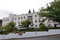
Hood River County Courthouse in Hood River
|
|
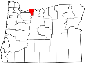
Location within the U.S. state of Oregon
|
|
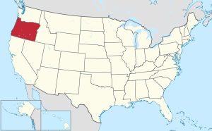 Oregon's location within the U.S. |
|
| Country | |
| State | |
| Founded | June 23, 1908 |
| Named for | Hood River |
| Seat | Hood River |
| Largest city | Hood River |
| Area | |
| • Total | 533 sq mi (1,380 km2) |
| • Land | 522 sq mi (1,350 km2) |
| • Water | 11 sq mi (30 km2) 2.1%% |
| Population
(2020)
|
|
| • Total | 23,977 |
| • Estimate
(2022)
|
23,745 |
| • Density | 43/sq mi (17/km2) |
| Time zone | UTC−8 (Pacific) |
| • Summer (DST) | UTC−7 (PDT) |
| Congressional district | 3rd |
Hood River County is one of the 36 counties in the U.S. state of Oregon. About 24,000 people lived there in 2020. The main town and county seat is Hood River.
The county was started in 1908. It is named after the Hood River, which flows into the Columbia River. The Hood River Valley is famous for growing fruits like apples, pears, and cherries.
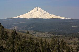
Located between Mount Hood and the Columbia River Gorge, Hood River County is a very popular place for outdoor fun! People love to go windsurfing, mountain biking, skiing, hiking, and kayaking there.
Contents
History of Hood River County
The first people to settle permanently in what is now Hood River County arrived in 1854. They claimed land under a special law. The first school was built in 1863. A road from The Dalles was finished in 1867. By 1880, 17 families lived in the valley. Later in the 1800s, farmers from Japan, Finland, Germany, and France also settled there.
Around 1900, people in the Hood River area wanted to form their own county. This area was part of Wasco County at the time. A statewide vote helped make Hood River the 34th county in Oregon. It officially became a county on June 23, 1908.
The Historic Columbia River Highway was completed in 1922. This road connected Portland to The Dalles. It made it much easier to travel to and from Hood River.
In 2003, people in the county voted on a new rule. This rule said that large housing projects (25 homes or more) on forest land needed voter approval. This vote happened because of a disagreement about building a resort near the Cooper Spur ski area on Mount Hood.
Geography and Nature
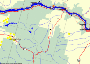
Hood River County covers about 533 square miles. Most of this is land (522 square miles), and 11 square miles is water. It is the second-smallest county in Oregon by land area. The land here goes from 60 feet above sea level near Cascade Locks to 11,235 feet at the top of Mount Hood. Mount Hood is the highest point in Oregon.
The county is in a special area called the Columbia River Gorge. This is where the wet forests of the Cascade Mountains meet the dry deserts of eastern Oregon. Because of this, the amount of rain changes a lot across the county. Cascade Locks gets over 76 inches of rain each year. But the city of Hood River gets less than 31 inches. Mount Hood can get up to 150 inches of rain or snow every year!
The Columbia River Gorge also affects the weather. Cool, moist air from the coast can move through the Gorge. This helps keep temperatures mild near the Columbia River. But sometimes, very cold air can also blow through the Gorge from the east.
Winds usually blow from the west in the summer. This creates strong, steady winds on the Columbia River near Hood River. These winds make Hood River a world-famous place for windsurfing. In winter, winds can blow from the east or west. Strong winds can sometimes cause damage.
Hood River County includes the entire Hood River watershed. A watershed is an area of land where all the water drains into one river or body of water. This watershed covers almost two-thirds of the county. It has four main parts: the West Fork, Middle Fork, East Fork, and the main Hood River.
A large part of the county, about 60%, is federal land. This land is managed by the Mount Hood National Forest. The county also owns about 8.8% of the forestland. The State of Oregon owns a smaller amount. Many private farms also operate in the county. As of 2012, there were 554 farms, with an average size of 19 acres.
Neighboring Counties
Hood River County shares borders with these other counties:
- Skamania County, Washington - to the north
- Klickitat County, Washington - to the northeast
- Wasco County - to the southeast
- Clackamas County - to the southwest
- Multnomah County - to the west
Protected Natural Areas
Several special natural areas are found in Hood River County:
- Badger Creek Wilderness
- Mark O. Hatfield Wilderness
- Mount Hood Wilderness
- Columbia River Gorge National Scenic Area
Population Information
| Historical population | |||
|---|---|---|---|
| Census | Pop. | %± | |
| 1910 | 8,016 | — | |
| 1920 | 8,315 | 3.7% | |
| 1930 | 8,938 | 7.5% | |
| 1940 | 11,580 | 29.6% | |
| 1950 | 12,740 | 10.0% | |
| 1960 | 13,395 | 5.1% | |
| 1970 | 13,187 | −1.6% | |
| 1980 | 15,835 | 20.1% | |
| 1990 | 16,903 | 6.7% | |
| 2000 | 20,411 | 20.8% | |
| 2010 | 22,346 | 9.5% | |
| 2020 | 23,977 | 7.3% | |
| 2023 (est.) | 23,745 | 6.3% | |
| U.S. Decennial Census 1790–1960 1900–1990 1990–2000 2010–2020 |
|||
People in 2010
In 2010, there were 22,346 people living in Hood River County. There were 8,173 households, which are groups of people living together. The county had about 43 people per square mile.
Most people (83.1%) were white. About 29.5% of the population was of Hispanic or Latino background. Many people had German (16.7%), English (10.6%), or Irish (9.8%) ancestors.
About 36% of households had children under 18 living with them. The average age of people in the county was 38 years old. The average income for a family was about $57,644 per year. About 9.5% of the population lived below the poverty line.
Towns and Communities
Hood River County has several towns and communities.
Cities
- Cascade Locks
- Hood River (This is the main town, also called the county seat.)
Census-Designated Places
These are areas that are like towns but are not officially incorporated as cities.
Other Communities
Old Communities
These are places that used to be communities but are not anymore.
- Bloucher
- Conway
- Dukes Valley
- Holstein
- Viento
Economy and Jobs
In 2013, the biggest job sector in Hood River County was Health Care and Social Assistance. This means many people worked in hospitals, clinics, or helping others. Manufacturing was the second largest sector.
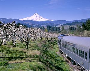
Farming, forestry, and tourism are also very important to the county's economy. The fertile valley is famous for its fruit. Hood River County leads the world in producing Anjou pears! In 1997, there were over 15,500 acres of orchards growing pears, apples, cherries, and peaches.
The Columbia River near Hood River city has become a top spot for windsurfing. On warm days, cool air from the coast gets pulled through the Columbia River Gorge. This creates strong winds, usually between 15 and 35 knots, most summer days. The river's current flows west, and the wind blows east. This creates big waves that windsurfers love to ride.
Windsurfing has really helped the local economy. New businesses and restaurants have opened in downtown Hood River. Many people who first visited for windsurfing have even moved to the area. This brings a lot of money from tourists into the local economy.
The Mount Hood Railroad carries goods and also offers fun train rides. It runs for 22 miles from Hood River to Parkdale. The train line was finished in 1909. It was bought by a local group in 1987, who named it the Mount Hood Railroad. In 2008, a company from Chicago bought it.
See also
 In Spanish: Condado de Hood River para niños
 | Valerie Thomas |
 | Frederick McKinley Jones |
 | George Edward Alcorn Jr. |
 | Thomas Mensah |


