Historic Columbia River Highway facts for kids
Quick facts for kids
|
|
|---|---|
| Lua error in Module:Infobox_road/map at line 15: attempt to index field 'wikibase' (a nil value). | |
| Route information | |
| Maintained by ODOT, OPRD, etc. | |
| Length | 74.1 mi (119.3 km)
(measured by historic mileposts)
|
| History | Constructed 1913–1922; bypassed in 1950s; added to NRHP on December 12, 1983 |
| Major junctions | |
| West end | Troutdale |
| Bridge of the Gods in Cascade Locks |
|
| East end | |
| Highway system | |
| Oregon highways Routes • Highways |
|
|
Columbia River Highway Historic District
|
|
| NRHP reference No. | 83004168 |
| Significant dates | |
| Added to NRHP | December 12, 1983 |
| Designated NHLD | May 16, 2000 |
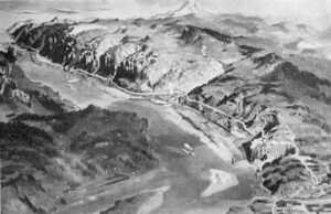
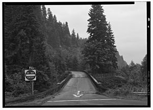
The Historic Columbia River Highway is a special road in Oregon. It stretches about 75 miles (121 km) between Troutdale and The Dalles. This amazing road was built through the beautiful Columbia River Gorge between 1913 and 1922.
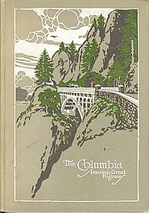
It was the first planned scenic road in the United States. Because of its unique design, it has received many awards. It is listed on the National Register of Historic Places and is a National Historic Landmark. It's even called an "All-American Road" because it's a destination all by itself!
Later, a newer, faster highway, Interstate 84, was built. This meant the old two-lane road was no longer the main route. Today, the Oregon Department of Transportation and the Oregon Parks and Recreation Department take care of different parts of the old highway.
The idea for this special road came from a lawyer named Sam Hill and an engineer named Samuel C. Lancaster. They wanted to create a road like the famous scenic roads in Europe. From the start, they imagined a road that wasn't just for cars like the Ford Model T. It was designed to show off all the natural beauty along the way.
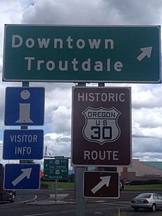
In 1926, the highway became part of U.S. Route 30. Over time, Interstate 84 was built next to it. This new highway became the main travel route. Some parts of the original historic road were lost or changed because of this.
Contents
History of the Highway
Building a Scenic Road
The Columbia River Gorge is a deep valley carved by the Columbia River. It's the lowest way to cross the Cascade Mountains. In the past, traveling through the gorge was very difficult. Thousands of pioneers on the Oregon Trail found it dangerous.
An early wagon road was built in the 1870s. But it was steep and narrow. Then, in 1882, a railroad was built, which damaged parts of the wagon road. When cars became popular in the early 1900s, a new road was needed.
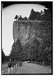
Building a road here was very challenging. At Shellrock Mountain, many thought it was impossible. But in 1912, Governor Oswald West used prison labor to show that a road could be built, even if it was just for a short time.
The main person behind the highway's design was Samuel C. Lancaster. He was an engineer and a friend of Samuel Hill. Hill was inspired by a road in Switzerland called the Axenstrasse, which had tunnels with windows. He wanted to build something similar in Oregon.
Hill even built a test road called the Maryhill Loops Road in Washington. It was the first asphalt road in that state. It had gentle curves to avoid steep hills. Hill then convinced Oregon lawmakers to create the State Highway Commission in 1913. This group would help build roads with the counties.
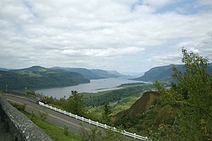
When designing the highway, Lancaster wanted to do more than just create a way to travel. He wanted to make the gorge's "beautiful waterfalls, canyons, cliffs and mountain domes" easy for everyone to see. He made sure the road included all the natural beauty spots. The goal was to make it a "great scenic boulevard" better than any other in the world.
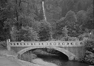
Lancaster started surveying the route in September 1913. He planned about 21 miles (34 km) of road. The road was designed to be wide enough for cars and had gentle slopes. To handle rainwater, he designed a special drainage system. He also included many reinforced concrete bridges and tunnels. These helped the road go over streams and along steep hillsides.
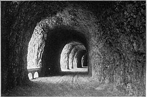
At Oneonta Bluff, the highway went through the first of five tunnels. By October 1914, the road was open to traffic in some areas. In 1915, the road was paved with a special long-lasting material called Warrenite.
The western part of the highway used and improved existing roads. A new steel bridge was built over the Sandy River in 1914. This was part of the highway project.
Beyond Multnomah County, engineer John Arthur Elliott planned the route through Hood River County. The most challenging spot was Mitchell Point. Here, the old road was very steep. Elliott solved this by building the Mitchell Point Tunnel. This tunnel had windows, just like the one in Switzerland that inspired Sam Hill.
Construction began in March 1915. The Mitchell Point section opened in September. To celebrate the highway's completion between Portland and Hood River, two ceremonies were held in June 1916. They took place at Multnomah Falls and Crown Point.
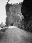
The final part of the highway, between Hood River and The Dalles, was also difficult to build. It included the Mosier Twin Tunnels, finished in 1920. These tunnels also had windows. Many photographers documented the building of this beautiful highway.
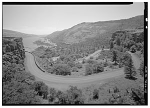
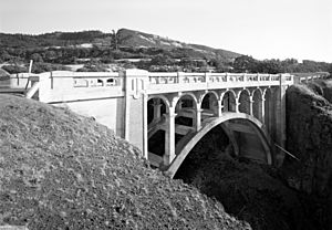
The last section of the highway went inland and included the Rowena Loops. These loops helped the road go down to the river level. Many of the bridges in this area were designed by Conde McCullough. He later became famous for his work on the Oregon Coast Highway.
The entire Columbia River Highway was officially completed on June 27, 1922. By then, it was part of a larger state highway system. In 1926, it was named part of U.S. Route 30.
Newer Roads and Restoration
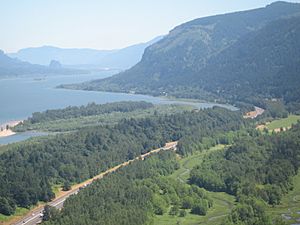
Even after the highway was finished, cars were getting faster. People wanted to get to their destinations more quickly, not just take a scenic drive. Also, there were problems with rocks falling onto the road.
By 1932, Samuel Lancaster suggested building a new, faster road. This would keep the old road as a scenic route. The first bypass was needed because of the Bonneville Dam. The dam would flood the railroad, so the highway had to be moved to make space for the railroad. This new section of highway was finished in 1937.
By the late 1940s, the highway was widened. The Mosier Twin Tunnels were also made wider in 1938 for bigger trucks. But they were still too narrow, so traffic signals were put in to control cars going through one at a time. The Oneonta Tunnel was closed in 1948. It was reopened 55 years later as part of a restoration project.
More plans for bypasses started in 1941. These new highways would be faster and more direct.
Restoring the Highway Today
Starting in 2006, the Oregon Department of Transportation began restoring the Oneonta Tunnel. They spent about $1.5 million to make it look like it did in the 1920s. The tunnel officially reopened on March 21, 2009, for people walking and biking.
In September 2017, the Eagle Creek Fire caused rockslides in the Gorge. This closed the historic highway for a year. It reopened on November 23, 2018, after a lot of repair work.
Exploring the Highway Today
Today, parts of the original highway are still open for cars. Other parts are now trails for walking and biking. The Historic Columbia River Highway (HCRH) covers 74 miles of the original road.
About 40 miles of the route are open to cars:
- The western 24 miles start in Troutdale. This section lets you visit many hiking trails, the Crown Point Vista House, and beautiful waterfalls like Multnomah Falls.
- The eastern 16 miles end in The Dalles.
The other parts of the HCRH are for people walking or biking. These are called the Historic Columbia River Highway State Trail. About seven miles between Hood River and Mosier have been open since 2000. This section goes through the historic Mosier Twin Tunnels.
Once all the restoration work is done, the highway will be a great scenic and alternative route for bikes. It will connect The Dalles and Portland.
The Columbia River Highway is the oldest scenic highway in the United States. In 1984, it was recognized as a National Historic Civil Engineering Landmark. In 2000, it was named a National Historic Landmark. This was because it's an amazing example of how modern highways were developed.
 | Bessie Coleman |
 | Spann Watson |
 | Jill E. Brown |
 | Sherman W. White |


