Sandy River (Oregon) facts for kids
Quick facts for kids Sandy River |
|
|---|---|

Sandy River and Mount Hood
|
|
|
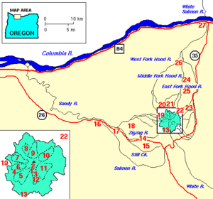
Location of the mouth of the Sandy River in Oregon
|
|
| Country | United States |
| State | Oregon |
| County | Clackamas County, Multnomah County |
| Physical characteristics | |
| Main source | Mount Hood Clackamas County, Oregon 5,225 ft (1,593 m) 45°22′32″N 121°43′45″W / 45.37556°N 121.72917°W |
| River mouth | Columbia River near Troutdale, Multnomah County, Oregon 10 ft (3.0 m) 45°34′05″N 122°24′03″W / 45.56806°N 122.40083°W |
| Length | 57 mi (92 km) |
| Basin features | |
| Basin size | 508 sq mi (1,320 km2) |
| Type: | Wild, Scenic, Recreational |
| Designated: | October 28, 1988 |
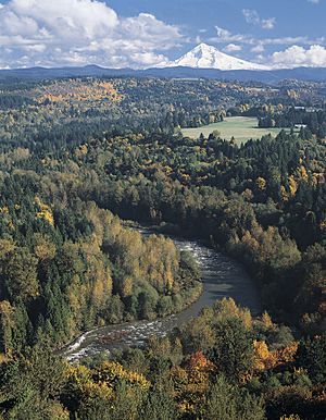
The Sandy River is a 56-mile (90 km) long river in northwestern Oregon, United States. It flows into the mighty Columbia River about 14 miles (23 km) east of Portland. The river got its name, "Quicksand River," from explorers Lewis and Clark in 1805 because of all the sand at its mouth. Later, people just started calling it the Sandy River.
Contents
Where Does the Sandy River Flow?
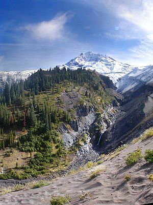
The Sandy River starts high up on Mount Hood in the Cascade Range. It begins at the Reid Glacier. From there, it flows west and then north for about 57 miles (92 km). It passes through Clackamas County and Multnomah County. Finally, it reaches the Columbia River near Troutdale.
In its early parts, the river flows through a flat area called Old Maid Flat. This area is part of the Mount Hood National Forest. Along the way, smaller streams like Muddy Fork and Clear Creek join the Sandy River.
Further downstream, the Zigzag River flows into the Sandy near the town of Zigzag. The Sandy River then runs close to U.S. Route 26 for many miles. It also passes by small towns like Wemme and Brightwood.
An important river called the Salmon River also joins the Sandy. Later, the Sandy River flows past the city of Sandy. It then turns north-northwest for the rest of its journey. Near Dodge Park, the Bull Run River adds its waters to the Sandy.
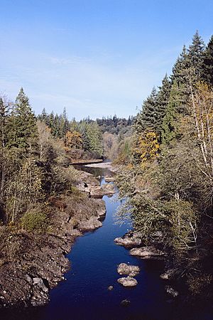
The river winds through Oxbow Regional Park, a popular spot for outdoor activities. Near its end, it passes Dabney State Recreation Area and Lewis and Clark State Recreation Site. Finally, the Sandy River flows under Interstate 84 and joins the Columbia River. This meeting point is close to the beautiful Columbia River Gorge.
How Much Water Does the River Carry?
Scientists measure how much water flows in the Sandy River. Near Dodge Park, the river's average flow is about 2,300 cubic feet per second (65 m3/s). This is like 2,300 basketballs of water passing by every second! The most water ever recorded was 84,400 cubic feet per second (2,390 m3/s). The least was 45 cubic feet per second (1.3 m3/s).
A Look Back: Sandy River's History
People have lived along the lower Columbia River for a very long time, possibly as far back as 10,000 years ago. Native American tribes lived in villages near the river. They would travel to gather berries, fish for salmon, and hunt animals like elk and deer. It's very likely they used the Sandy River too.
These early people left behind petroglyphs, which are carvings in rocks, in the Columbia River Gorge. Over time, they created trails across the Cascade Range around Mount Hood. These trails connected trading centers with other settlements. One famous trail later became the Barlow Road.
In 1792, an explorer named William Robert Broughton saw the Sandy River. He called it "Baring River." He noticed a huge sand bank at its mouth. Later, in 1805, Lewis and Clark explored the river. Mount Hood had erupted a few years before, sending a lot of sand and dirt into the river. William Clark wrote about how shallow and full of "quick sand" the river was.
In 1838, one of the first European-Americans to visit the upper Sandy River was Daniel Lee. He used an old Indian trail to move cattle. Later, many settlers used the Oregon Trail to move west. The Barlow Road, which followed an Indian trail, opened in 1846. It became a very popular route for new settlers.
Dams Removed: A River Restored
For many years, the Sandy River had dams that controlled its flow. These dams were part of the Bull Run Hydroelectric Project. Water was sent from the Sandy River to the Little Sandy River. Then it flowed to an artificial lake called Roslyn Lake. This lake helped power a hydroelectric plant, which made electricity.
But in 2007, engineers used explosives to remove Marmot Dam. The next year, Little Sandy Dam was also taken down. When Marmot Dam was gone, the Sandy River flowed freely for the first time since 1912! This was a huge change.
Removing the dams helped the river's ecosystem. Now, fish like steelhead and salmon can swim up the Little Sandy River again. This is the first time in about 100 years! The company that owned the dams also gave over 1,500 acres (6.1 km2) of land to a nature reserve. Efforts are being made to restore the river's banks and create better homes for fish.
Fun Things to Do at the Sandy River
The Sandy River is a great place for outdoor fun! In 1988, parts of the Sandy River were added to the National Wild and Scenic Rivers System. This means these parts of the river are protected for their natural beauty and special qualities.
Many people enjoy visiting the Sandy River. Here are some popular activities:
- Hiking: There are many trails, including one to Ramona Falls, a beautiful waterfall.
- Fishing: The river is a good spot for fishing.
- Backpacking and Camping: You can explore the wilderness and camp overnight.
- Kayaking and Cross-Country Skiing: These are popular activities in the upper parts of the river.
- Boating and Floating: In the lower river, people enjoy non-motorized boating and floating.
- Picnicking: Many parks along the river offer great spots for a picnic.
Some of the parks you can visit along the Sandy River include Dodge Park, Oxbow Regional Park, Dabney State Recreation Area, Lewis and Clark State Recreation Site, and Glenn Otto Park.
 | James Van Der Zee |
 | Alma Thomas |
 | Ellis Wilson |
 | Margaret Taylor-Burroughs |


