Bull Run River (Oregon) facts for kids
Quick facts for kids Bull Run River |
|
|---|---|
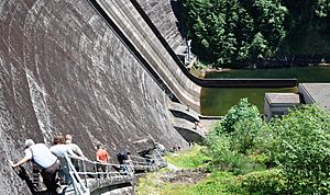
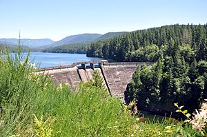
Visitors descend the downstream side of Dam 1 on the Bull Run River.
|
|
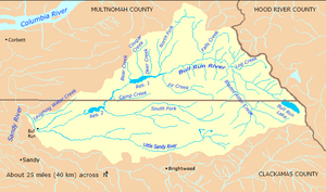
Bull Run River watershed
|
|
|
Location of the mouth of the Bull Run River in Oregon
|
|
| Country | United States |
| State | Oregon |
| County | Clackamas County, Multnomah County |
| Physical characteristics | |
| Main source | Mount Hood National Forest near Bull Run Lake, Clackamas County, Oregon 4,259 ft (1,298 m) 45°26′09″N 121°48′39″W / 45.43583°N 121.81083°W |
| River mouth | Sandy River Dodge Park, Clackamas County, Oregon 243 ft (74 m) 45°26′46″N 122°14′48″W / 45.44611°N 122.24667°W |
| Length | 21.9 mi (35.2 km) |
| Basin features | |
| Basin size | 140 sq mi (360 km2) |
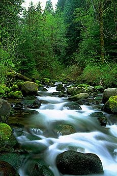
The Bull Run River is a 21.9-mile (35.2 km) long river in Oregon, USA. It flows into the Sandy River. The river starts at Bull Run Lake in the Cascade Range mountains. It flows west through a special protected area called the Bull Run Watershed Management Unit. This area keeps the river and its smaller streams clean. The Bull Run River is the main source of drinking water for the city of Portland, Oregon.
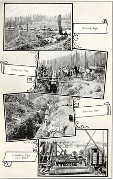
Long ago, Native Americans visited the Bull Run area to find food. They created trails over the Cascade Mountains. Later, pioneers used these trails to cross the mountains. In the 1890s, the city of Portland needed clean drinking water. They chose the Bull Run River. They started building dams and pipes to bring water to the city in 1895.
The ground under the watershed is mostly hard rock called basalt. This helps keep the water clean. But sometimes, during heavy rains, soft soils can wash into the river. This makes the water cloudy. Even though the area is protected, some logging happened in the past. This caused more soil to wash into the river. In 1996, Portland had to stop using Bull Run water for a short time because it was too cloudy. A new law was passed to stop most logging. Now, the Portland Water Bureau and the United States Forest Service work together. They close old logging roads to prevent erosion.
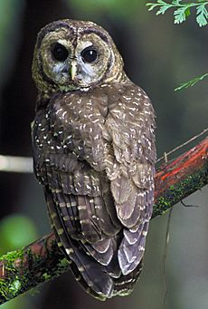
About half of the watershed is covered with very old, tall trees. The rest is also heavily forested. Lots of rain falls here every year. Over 250 types of animals live in this forest, including the protected northern spotted owl. Closer to the Sandy River, the land is less restricted. A small town called Bull Run grew up near the river. This was because of a project that made electricity from water. You can fish and boat on about 6 miles (10 km) of the lower river. The place where the Bull Run and Sandy rivers meet has been a public park for a long time.
Contents
Journey of the Bull Run River
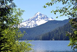
The Bull Run River begins at Bull Run Lake. This lake is in the Mount Hood Wilderness area. The lake's water level is controlled by the Portland Water Bureau. The river flows from the lake, first into Multnomah County. It flows northwest for about 5 miles (8 km). Along this part, smaller streams like Blazed Alder Creek join it.
Then, the river turns southwest. It flows into Bull Run River Reservoir 1. Other creeks like Fir Creek and North Fork Bull Run River also flow into this reservoir. The Bull Run River then leaves Reservoir 1 through a special overflow area called a spillway.
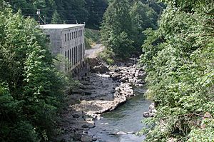
Next, the river enters Bull Run River Reservoir 2. Camp Creek and South Fork Bull Run River join it here. The river leaves Reservoir 2 through another spillway. Below Reservoir 2, the Little Sandy River joins the Bull Run River. The river then flows past the community of Bull Run. It also passes an old building that used to make electricity. Finally, the Bull Run River flows into the Sandy River at Dodge Park.
How Much Water Flows?
Scientists measure how much water flows in the Bull Run River. One measuring station is about 4.7 miles (7.6 km) from the river's mouth. This station does not count the water that goes to Portland for drinking. The most water ever recorded at this station was 24,800 cubic feet per second (700 m3/s) on December 22, 1964. This was during a very big flood. The least water was 1.1 cubic feet per second (0.031 m3/s) on October 4, 1974.
Another station, 14.8 miles (23.8 km) from the mouth, has been measuring since 1966. The average flow here is 404 cubic feet per second (11.4 m3/s). The most water recorded here was 15,800 cubic feet per second (450 m3/s) on November 5, 1999. The least was 30 cubic feet per second (0.85 m3/s) in October 1987.
The highest measuring station is near Bull Run Lake. It has been working since 1992. The average flow there is 26.1 cubic feet per second (0.74 m3/s). The most water was 148 cubic feet per second (4.2 m3/s) on February 7, 1996. The least was 8.2 cubic feet per second (0.23 m3/s) on October 28, 1992.
There are also five other measuring stations on smaller streams that flow into the Bull Run River. These include Fir Creek and the North and South Forks of the Bull Run.
River Rocks and Reservoirs
Most of the Bull Run watershed sits on very old rocks called Columbia River basalts. These rocks are 10 to 20 million years old. They are very hard and don't erode easily. This means that water flowing over them stays clean and doesn't pick up much dirt.
The Bull Run River has three main water storage areas: Bull Run Lake, Bull Run Reservoir 1, and Bull Run Reservoir 2. These are like very clean, clear lakes that don't have much plant or animal life. Bull Run Lake is in a steep valley. Water flows into it from nearby ridges. Water leaves the lake by seeping through porous rock to join the Bull Run River. Even after forest fires or volcano eruptions, the lake usually returns to its clean state.
Sometimes, the water in Reservoirs 1 and 2 can get cloudy. This happens when unstable soils between layers of lava wash into the smaller streams, especially during heavy rains.
History of the Bull Run River
Early People and Trails
People have lived along the Columbia River for about 10,000 years. They likely visited the Bull Run area to find food. They created trails over the Cascade Range mountains. In the 1800s, pioneers used these trails to cross the mountains and settle in the Willamette Valley. One important trail went over Lolo Pass, near where the Bull Run River starts.
Settlers and Portland's Water
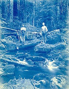
In 1886, the city of Portland started looking for a good source of drinking water. An engineer named Isaac W. Smith suggested the Bull Run River. He found that water could flow by gravity from Bull Run all the way to Portland. In 1892, the U.S. President created the Bull Run Reserve. This was a protected area for the watershed. By 1895, Portland had built a dam and a large pipe to carry Bull Run water to the city.
Over the years, Portland built more dams and pipes to get more water. In 1917, they built a small dam at Bull Run Lake. In 1929, they built Dam 1, which is about 200 feet (61 m) high. In 1962, they built Dam 2, which is about 110 feet (34 m) high. These dams created large reservoirs to store water for the growing city.
Making Electricity from Water
In 1906, a company started building a project to make electricity from the Bull Run River. They built a power station and diverted water from the Little Sandy River. This water flowed through a long wooden channel to a lake called Roslyn Lake, and then to the power station. A railway line was built to help with this project.
Later, another dam was built on the Sandy River. This dam sent even more water to the Little Sandy River, increasing the amount of water flowing to the power station. This project changed the natural flow of three rivers. In 1999, the company decided to remove these dams because they were old and expensive to maintain. The dams were taken down in 2007 and 2008. This allowed the Sandy and Little Sandy rivers to flow naturally again.
Since 1982, Portland has also made electricity from the dams on the Bull Run River itself. They have two power plants, one at Dam 1 and one at Dam 2. This electricity is sold to a power company.
Logging in the Forest
Logging started in the Sandy River area in the mid-1800s. In 1904, a law was passed to protect the Bull Run Reserve. It stopped activities like camping and grazing animals. For many years, the protected area stayed mostly untouched.
But in the 1950s, the United States Forest Service started to allow logging in the Reserve. They built about 170 miles (270 km) of roads in the watershed. This logging caused more soil to wash into the river. In 1976, a judge stopped the logging. Then, a new law was passed in 1977 that allowed logging again, but only if it didn't harm water quality.
In 1996, heavy rains caused a lot of eroded soil to wash into the reservoirs. Portland had to switch to emergency water from wells. After this, a new law was passed that stopped almost all logging in the Bull Run water supply area. Since then, the Forest Service and the water bureau have been closing old logging roads and removing pipes that caused erosion. Between 1958 and 1993, about 22 percent of the water supply area was logged. Now, efforts are focused on restoring the forest and protecting the water.
About the Bull Run Watershed
The Bull Run watershed covers about 139 square miles (360 km2). Most of it is in the Mount Hood National Forest in Oregon. The river flows into the Sandy River about 20 miles (32 km) east of Portland. The highest point in the watershed is Buck Peak, at 4,750 feet (1,450 m) high. The lowest point is where the river meets the Sandy River, at 243 feet (74 m) high.
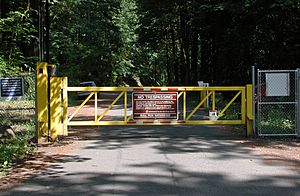
Because it's Portland's main drinking water source, most of the watershed is restricted. Only people working to manage the water and forest are allowed in. The main protection area covers 102 square miles (260 km2). This is part of a larger restricted zone called the Bull Run Watershed Management Unit (BRWMU), which is 143 square miles (370 km2). The United States Forest Service manages most of this land. The Portland Water Bureau manages a smaller part that they own.
Other rivers and creeks border the Bull Run watershed. To the east, it borders the Hood River. To the south and west, it borders the Sandy River. To the north, it borders the Columbia River. Many small creeks flow from the ridge between the Bull Run and Columbia rivers. These creeks create beautiful waterfalls as they drop into the Columbia Gorge.
Weather in the Watershed
The weather in the Bull Run area is typical for the western Oregon mountains. It rains a lot, especially from November to January. Summers are dry. Near the headwaters, up to 170 inches (4,300 mm) of rain falls each year. At lower elevations, it's about 80 inches (2,000 mm). At higher elevations, 25 to 30 percent of the rain falls as snow. This snow can be very deep, especially above 4,000 feet (1,200 m). When the snow melts in spring, it adds water to the streams.
Temperatures are usually mild. In January, lows are around 25 °F (−4 °C), and in July, highs are about 80 °F (27 °C).
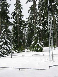
Special stations called SNOTEL stations measure the snow. They help predict how much water will be available from melting snow. For example, at the Blazed Alder Creek station, the amount of water in the snow can reach about 50 inches (1,300 mm) in April.
Water System and Roads
Even though the public can't enter most of the watershed, there are roads, buildings, and dams for managing the water. There are three dams and reservoirs: Bull Run Lake, Reservoir 1, and Reservoir 2. The dam at Bull Run Lake helps store more water. Dam 1 is a concrete dam about 200 feet (61 m) high. Dam 2 is a rock dam about 110 feet (34 m) high. Together, the reservoirs can hold a lot of water for Portland.
The water for Portland is taken from the river just below Dam 2. Here, the water is treated and sent through large pipes to the city. About 23 percent of the river's yearly water flow goes to Portland's drinking supply.
The main roads inside the protected area are for government workers. Forest Road 10 runs along the north side of the river. It connects to other roads near the lake. Outside the protected area, Bull Run Road crosses the river.
The Bull Run River Bridge, which carries Bull Run Road, is very old. It was once part of a larger bridge in downtown Portland. It was moved here in 1926.
Plants and Animals
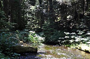
Thick forests cover about 95 percent of the watershed. Douglas-fir trees are common at lower elevations. Western hemlock and western redcedar also grow there. At higher elevations, you'll find Douglas-fir and noble fir. Many of the trees are very old, over 500 years old. The forest floor has smaller plants like salal and sword fern.
Over 250 types of animals live in the watershed. These include birds like peregrine falcons, bald eagles, and northern spotted owls. Migratory birds like loons also use the area. The river is home to native fish like chinook and coho salmon, steelhead, and coastal cutthroat trout. However, dams block fish from swimming to the upper parts of the river.
Many amphibians and reptiles live near the streams. You might also see mammals like Roosevelt elk, black bears, coyotes, cougars, black-tailed deer, and North American beavers.
Fun Things to Do
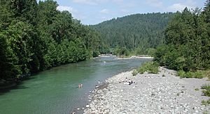
Dodge Park is a great place to visit. It's located where the Bull Run River meets the Sandy River. The park has picnic areas, a swimming hole, a sandy beach, and a boat ramp. You can launch rafts, kayaks, and drift boats on the Sandy River from here. The Portland Water Bureau owns and takes care of the park. It was named after Frank Dodge, who was in charge of the water bureau for many years.
Even though most of the Bull Run River is closed to the public, you can go whitewater rafting or kayaking on the lower 2.5-mile (4.0 km) stretch. This part of the river has some exciting rapids.
Fishing is allowed only in the lower parts of the river. You might catch hatchery Chinook salmon or steelhead. You can also do catch and release fishing for wild trout near the river's mouth.
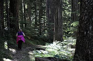
The main Bull Run Watershed Management Unit is usually closed to visitors. Security guards watch the entrances. But the water bureau offers public tours in the summer and fall. You can also hike on the Pacific Crest Trail, which runs along the eastern edge of the watershed near Mount Hood.
 | Selma Burke |
 | Pauline Powell Burns |
 | Frederick J. Brown |
 | Robert Blackburn |


