Cogra Moss facts for kids
Quick facts for kids Cogra Moss |
|
|---|---|
 |
|
| Location | Lake District |
| Coordinates | 54°33′48″N 3°24′04″W / 54.56333°N 3.40111°W |
| Type | reservoir |
| Catchment area | 245 hectares (0.95 sq mi) |
| Basin countries | United Kingdom |
| Surface area | 16 hectares (40 acres) |
| Average depth | 5.4 metres (18 ft) |
| Water volume | 0.84×10⁶ m3 (680 acre⋅ft) |
| Shore length1 | 2 km (1.2 mi) |
| Surface elevation | 225 metres (738 ft) |
| 1 Shore length is not a well-defined measure. | |
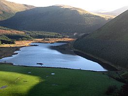
Cogra Moss is a calm, shallow reservoir located on the western edge of England's famous Lake District. It sits just east of the small village of Lamplugh. This peaceful spot is a favorite for people who enjoy walking and fishing.
Contents
What is Cogra Moss?
Cogra Moss is a special type of lake called a reservoir. It wasn't always here naturally. It was created around 1880 when a stream called Rakegill Beck was blocked by a large wall, known as a dam.
Why was Cogra Moss built?
The main reason Cogra Moss was built was to store water. It used to provide water for people living nearby. However, it stopped being used for water supply in 1975.
Where is Cogra Moss located?
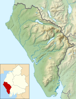
Cogra Moss is found in the beautiful Lake District, a national park known for its stunning mountains and lakes. It's specifically on the western side of the park, close to the village of Lamplugh. The reservoir is surrounded by many trees, mostly in forestry plantations.
Fun things to do at Cogra Moss
Even though it's no longer a water supply, Cogra Moss is a popular place for outdoor activities.
- Walking: Many people enjoy walking around the reservoir. The paths offer lovely views of the water and the surrounding forests.
- Fishing: Anglers, or people who like to fish, also visit Cogra Moss. It's a great spot to relax and try to catch some fish.
Cogra Moss is a wonderful example of how places can change their purpose over time. From providing water to being a peaceful spot for nature lovers, it continues to be an important part of the Lake District landscape.
 | Stephanie Wilson |
 | Charles Bolden |
 | Ronald McNair |
 | Frederick D. Gregory |


