Cohagen, Montana facts for kids
Quick facts for kids
Cohagen, Montana
|
|
|---|---|

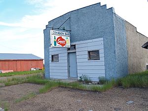
Cohagen Bar in Cohagen, Montana
|
|
| Country | United States |
| State | Montana |
| County | Garfield |
| Elevation | 2,720 ft (830 m) |
| Time zone | UTC-7 (Mountain (MST)) |
| • Summer (DST) | UTC-6 (MDT) |
| ZIP codes |
59322
|
| GNIS feature ID | 806931 |
Cohagen is a small, quiet community in southeastern Montana, United States. It's not a city or town with its own government, but rather an unincorporated community. This means it's a group of homes and businesses that are part of a larger county.
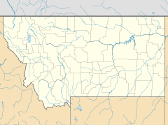
Cohagen is located in Garfield County. You can find it along Highway 59. It is southeast of Jordan, which is the main town and county seat of Garfield County. Cohagen sits at an elevation of about 2,720 feet (829 meters) above sea level.
History of Cohagen
The community of Cohagen has a history that goes back to the early 1900s. Its post office first opened its doors on August 18, 1905. The ZIP code for Cohagen is 59322.
The name "Cohagen" comes from the mother's maiden name of the very first postmaster, Harry Harris. In more recent times, in September 2020, people in Cohagen had to leave their homes. This was because of a wildfire that threatened the area.
Understanding Cohagen's Climate
Cohagen experiences a type of weather known as a semi-arid climate. This means the area is quite dry, but not as dry as a desert. It gets some rain, but not a lot.
In a semi-arid climate, summers are usually warm to hot. Winters are typically cold. The amount of rain or snow that falls throughout the year is generally low. This kind of climate is common in parts of the western United States.
 | Georgia Louise Harris Brown |
 | Julian Abele |
 | Norma Merrick Sklarek |
 | William Sidney Pittman |


