Collores, Jayuya, Puerto Rico facts for kids
Quick facts for kids
Collores
|
|
|---|---|
|
Barrio
|
|

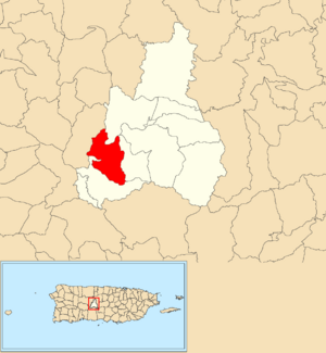
Location of Collores within the municipality of Jayuya shown in red
|
|
| Commonwealth | |
| Municipality | |
| Area | |
| • Total | 3.49 sq mi (9.0 km2) |
| • Land | 3.49 sq mi (9.0 km2) |
| • Water | 0.00 sq mi (0 km2) |
| Elevation | 1,499 ft (457 m) |
| Population
(2010)
|
|
| • Total | 1,666 |
| • Density | 477.4/sq mi (184.3/km2) |
| Source: 2010 Census | |
| Time zone | UTC−4 (AST) |
Collores is a small community, also known as a barrio, located in the beautiful mountains of Jayuya, Puerto Rico. It's a part of the U.S. territory of Puerto Rico. In 2010, about 1,666 people lived in Collores.
Contents
Exploring Collores: Location and History
Where is Collores Located?
Collores is found within the municipality of Jayuya, Puerto Rico. A municipality in Puerto Rico is like a county or a large town area. Collores is one of the many barrios that make up Jayuya. It sits at an elevation of about 1,499 feet (457 meters) above sea level, which means it's in a hilly or mountainous area.
How Collores Was Formed
Collores became an official barrio in 1948. Before that, it was part of another area called Jayuya Arriba. This means it was once a section of a larger community before it was given its own name and boundaries.
Population Changes Over Time
The number of people living in Collores has changed over the years. Here's a quick look at how its population has grown and shrunk:
- In 1950, there were about 1,823 people living in Collores.
- By 1980, the population had decreased to around 1,435 residents.
- In 2000, it grew slightly to 1,496 people.
- The most recent count in 2010 showed 1,666 residents.
These numbers come from the U.S. Decennial Census, which counts the population every ten years.
See also
 In Spanish: Collores (Jayuya) para niños
 | Selma Burke |
 | Pauline Powell Burns |
 | Frederick J. Brown |
 | Robert Blackburn |


