Connolly Basin crater facts for kids

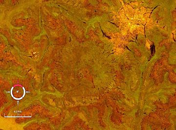
Landsat image of the Connolly Basin crater (circular feature in centre); screen capture from NASA World Wind
|
|
| Impact crater/structure | |
|---|---|
| Confidence | Confirmed |
| Diameter | 9 km (5.6 mi) |
| Depth | 25–30 m (82–98 ft) |
| Age | <60 Ma Paleocene |
| Exposed | Yes |
| Drilled | No |
| Location | |
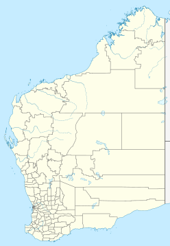
| Location | Gibson Desert |
| Coordinates | 23°32.3′S 124°45.4′E / 23.5383°S 124.7567°E |
| Country | Australia |
| State | Western Australia |
| Access | Talawana Track |
The Connolly Basin is a large, bowl-shaped hole in the ground called an impact crater. It is about 9 kilometers (5.6 miles) wide. This crater is found in the Gibson Desert in the middle of Western Australia.
It's quite a remote spot, located near the Talawana Track. Getting there can be tricky because the area is very isolated. For a long time, people thought it was a natural salt dome, but scientists discovered in 1985 that it was actually made by something hitting Earth.
What is the Connolly Basin Crater Like?
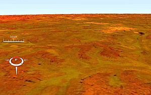
The Connolly Basin crater looks like a big, round dip in the ground. It has a raised edge, like a rim, which is about 25 to 30 meters (82 to 98 feet) high. In the very center of the crater, there's a small, circular bump. This bump is about 1 kilometer (0.6 miles) wide and 5 meters (16 feet) high.
Scientists believe this central bump is a "central uplift." This happens when the ground bounces back up after a huge object crashes into it. The rocks in this central area are very squished and tilted.
How Old is the Crater?
The rocks that make up the rim of the crater formed a very long time ago. They are from the Early Cretaceous Period to the Paleogene Period. The rocks in the central uplift are even older, from the Early Permian Period. All these rocks are part of a larger area called the Canning Basin.
Scientists think the actual impact that created the Connolly Basin crater happened during the Paleocene Epoch. This was about 60 million years ago, which is part of the early Paleogene Period.


