Contamana facts for kids
Quick facts for kids
Contamana
|
|
|---|---|

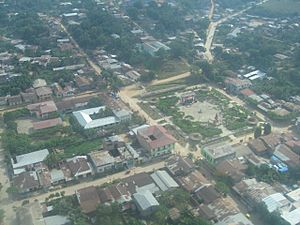
View of the town
|
|
| Country | Peru |
| Region | Loreto |
| Province | Ucayali |
| Elevation | 134 m (440 ft) |
| Population
(2007)
|
15,036 |
| Time zone | UTC-5 (PET) |
| Climate | Af |
| Website | www.muniucayali.gob.pe |
Contamana is a town located in the Loreto Region in northeastern Peru. It is an important place because it serves as the capital of both Ucayali Province and Contamana District. In 2007, about 15,036 people lived in the town area. Contamana also has its own airport, which helps people travel to and from this part of Peru.
Contents
Location and Geography
Contamana is found in the Amazon rainforest, a huge area known for its amazing nature. The town is built near rivers, which are like highways for people and goods in this region. Being in the Loreto Region means Contamana is part of Peru's largest region, famous for its dense forests and many waterways. The town is about 134 meters (around 440 feet) above sea level.
Climate
Contamana has a tropical rainforest climate. This means the weather is warm and rainy all year round. There isn't a big difference between seasons, so it's always quite humid.
Temperatures
The temperatures in Contamana are usually warm. The average high temperatures are often between 30 and 33 degrees Celsius (86 to 91 degrees Fahrenheit). Nighttime temperatures are also warm, usually staying above 18 degrees Celsius (64 degrees Fahrenheit).
Rainfall
Contamana gets a lot of rain throughout the year. The wettest months are typically from January to May, when heavy rains are common. Even in the drier months, there is still some rainfall. This constant rain helps the rainforest grow and stay green.
| Climate data for Contamana, elevation 157 m (515 ft), (1991–2020) | |||||||||||||
|---|---|---|---|---|---|---|---|---|---|---|---|---|---|
| Month | Jan | Feb | Mar | Apr | May | Jun | Jul | Aug | Sep | Oct | Nov | Dec | Year |
| Mean daily maximum °C (°F) | 32.5 (90.5) |
31.9 (89.4) |
31.3 (88.3) |
31.3 (88.3) |
30.8 (87.4) |
30.4 (86.7) |
30.8 (87.4) |
32.3 (90.1) |
32.9 (91.2) |
33.1 (91.6) |
33.0 (91.4) |
32.8 (91.0) |
31.9 (89.4) |
| Mean daily minimum °C (°F) | 20.2 (68.4) |
20.0 (68.0) |
20.0 (68.0) |
19.7 (67.5) |
19.3 (66.7) |
19.0 (66.2) |
18.6 (65.5) |
19.0 (66.2) |
19.6 (67.3) |
20.1 (68.2) |
20.3 (68.5) |
20.4 (68.7) |
19.7 (67.4) |
| Average precipitation mm (inches) | 147.2 (5.80) |
173.3 (6.82) |
207.7 (8.18) |
177.8 (7.00) |
147.7 (5.81) |
79.8 (3.14) |
69.9 (2.75) |
73.2 (2.88) |
109.5 (4.31) |
145.2 (5.72) |
158.1 (6.22) |
126.9 (5.00) |
1,616.3 (63.63) |
| Source: National Meteorology and Hydrology Service of Peru | |||||||||||||
Life in Contamana
Life in Contamana is closely connected to the Amazon River and the surrounding rainforest. Many people rely on the river for travel, fishing, and transporting goods. The town serves as a local center for trade and services for the smaller communities around it.
Economy and Activities
The economy in Contamana often involves:
- Fishing: The rivers are full of fish, which is a main food source and a way for people to earn money.
- Agriculture: Growing crops like plantains, yucca, and other fruits and vegetables common in the Amazon.
- Forestry: Using timber from the forest, but often with rules to protect the environment.
- Trade: Buying and selling goods with nearby towns and villages.
- Tourism: Some visitors come to experience the Amazon rainforest and its unique wildlife.
Transportation
Because Contamana is deep in the Amazon, rivers are very important for getting around. Boats are a common way to travel to other towns and villages. The town's airport also connects it to larger cities in Peru, making it easier for people and supplies to arrive.
See also
 In Spanish: Contamana para niños
 | Misty Copeland |
 | Raven Wilkinson |
 | Debra Austin |
 | Aesha Ash |


