Cortland, Ohio facts for kids
Quick facts for kids
Cortland, Ohio
|
|
|---|---|

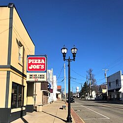
Downtown Cortland
|
|

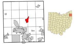
Location of Cortland in Trumbull County, Ohio.
|
|
| Country | United States |
| State | Ohio |
| County | Trumbull |
| Area | |
| • Total | 4.33 sq mi (11.22 km2) |
| • Land | 4.33 sq mi (11.22 km2) |
| • Water | 0.00 sq mi (0.00 km2) |
| Elevation | 1,037 ft (316 m) |
| Population
(2020)
|
|
| • Total | 7,105 |
| • Estimate
(2023)
|
7,062 |
| • Density | 1,640.88/sq mi (633.50/km2) |
| Time zone | UTC-5 (EST) |
| • Summer (DST) | UTC-4 (EDT) |
| ZIP code |
44410
|
| Area code(s) | 330, 234 |
| FIPS code | 39-18812 |
| GNIS feature ID | 2393640 |
| Website | http://www.cityofcortland.org |
Cortland is a friendly city located in Trumbull County, Ohio, in the United States. It sits right on the eastern side of Mosquito Creek Lake. About 7,105 people lived here in 2020. Cortland is part of a bigger area called the Youngstown–Warren metropolitan area.
Contents
History of Cortland
The area where Cortland is now was once called Baconsburg. This name came from Samuel Bacon. He built a sawmill and other buildings here a long time ago, in the early 1800s.
Cortland officially became a village in 1874. This happened when a railroad station was built there. The town grew, and in 1980, its population went over 5,000 people. Because of this, Cortland became a city.
Geography and Nature
Cortland covers about 4.25 square miles (11 square kilometers) of land. It does not have any large bodies of water within its city limits.
The city is located along the eastern shore of Mosquito Creek Lake. This lake is a popular spot for outdoor activities. Next to the lake is Mosquito Lake State Park, which offers even more chances to enjoy nature.
Population Changes
| Historical population | |||
|---|---|---|---|
| Census | Pop. | %± | |
| 1880 | 616 | — | |
| 1890 | 697 | 13.1% | |
| 1900 | 620 | −11.0% | |
| 1910 | 612 | −1.3% | |
| 1920 | 750 | 22.5% | |
| 1930 | 940 | 25.3% | |
| 1940 | 1,014 | 7.9% | |
| 1950 | 1,259 | 24.2% | |
| 1960 | 1,957 | 55.4% | |
| 1970 | 2,525 | 29.0% | |
| 1980 | 5,011 | 98.5% | |
| 1990 | 5,666 | 13.1% | |
| 2000 | 6,830 | 20.5% | |
| 2010 | 7,104 | 4.0% | |
| 2020 | 7,105 | 0.0% | |
| 2023 (est.) | 7,062 | −0.6% | |
| Sources: | |||
In 2010, about 7,104 people lived in Cortland. There were 3,010 homes. The city had about 1,671 people per square mile (645 people per square kilometer).
Most of the people living in Cortland are White (97.0%). A smaller number are African American (1.2%), Asian (0.5%), or Native American (0.2%). About 0.9% of the population identified as Hispanic or Latino.
Education in Cortland
Most students in Cortland attend schools run by Lakeview Local Schools. This district has one building for students from pre-kindergarten through 8th grade. It also has one high school, which is Lakeview High School.
Some homes in the eastern part of Cortland are part of the Mathews Local School District. Also, if you live north of Bradley Brownlee Road, your schools are in the Maplewood Local School District.
Cortland also has a public library. It is a branch of the Warren-Trumbull County Public Library system.
Roads and Transportation
The following main roads pass through Cortland, making it easy to travel to and from the city:
See also
 In Spanish: Cortland (Ohio) para niños


