Country Walk, Florida facts for kids
Quick facts for kids
Country Walk, Florida
|
|
|---|---|

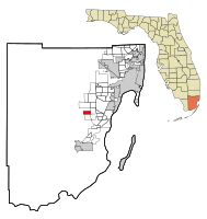
Location in Miami-Dade County and the state of Florida
|
|

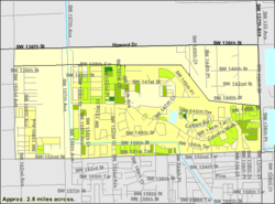
U.S. Census Bureau map showing CDP boundaries
|
|
| Country | |
| State | |
| County | |
| Area | |
| • Total | 2.62 sq mi (6.78 km2) |
| • Land | 2.58 sq mi (6.68 km2) |
| • Water | 0.04 sq mi (0.10 km2) |
| Elevation | 7 ft (2 m) |
| Population
(2020)
|
|
| • Total | 16,951 |
| • Density | 6,572.70/sq mi (2,537.79/km2) |
| Time zone | UTC-5 (Eastern (EST)) |
| • Summer (DST) | UTC-4 (EDT) |
| ZIP Codes |
33186, 33196 (Miami)
|
| Area code(s) | 305, 786, 645 |
| FIPS code | 12-15055 |
| GNIS feature ID | 1853243 |
Country Walk is a special kind of community in Miami-Dade County, Florida, in the United States. It's called a census-designated place (CDP). This means it's an area that the government counts as a separate place for population numbers, even though it's not officially a city or town.
Country Walk is part of the big Miami metropolitan area in South Florida. In 2020, about 16,951 people lived there. That's more than the 15,997 people who lived there in 2010!
Contents
Where is Country Walk?
Country Walk is located in Florida, a state in the southeastern United States. You can find it at these coordinates: 25°37′56″N 80°26′6″W / 25.63222°N 80.43500°W.

The community covers a total area of about 2.8 square miles (7.3 square kilometers). Most of this area is land, with a very small part being water.
A Look at Country Walk's History
Country Walk has an important story, especially about a big storm.
Hurricane Andrew's Impact
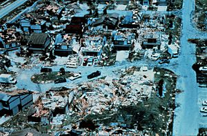
In August 1992, a very powerful storm called Hurricane Andrew hit Florida. Country Walk was one of the places that suffered the most damage. About 90% of the 1,700 homes in Country Walk were destroyed.
After the hurricane, many property owners took legal action. They said the homes were not built well by the developer, Arvida. Over the next few years, the homes were slowly rebuilt. The new homes were made with strong concrete walls, unlike the original wooden ones. Even though many parts of Miami were affected, Country Walk is still remembered as one of the worst-hit areas from Hurricane Andrew.
Who Lives in Country Walk?
The population of Country Walk has grown over the years.
Population Changes Over Time
Here's how the number of people living in Country Walk has changed:
- 2000: 10,653 people
- 2010: 15,997 people
- 2020: 16,951 people
People and Backgrounds in 2020
In 2020, there were 16,951 people living in Country Walk. These people lived in 4,729 households, and 4,090 of these were families.
The community is home to people from many different backgrounds. Here's a quick look at the racial makeup, not counting people of Hispanic or Latino origin:
- White (not Hispanic): 11.55%
- Black or African American (not Hispanic): 6.62%
- Native American or Alaska Native (not Hispanic): 0.08%
- Asian (not Hispanic): 2.58%
- Pacific Islander (not Hispanic): 0.03%
- Some Other Race (not Hispanic): 0.63%
- Mixed/Multi-Racial (not Hispanic): 1.93%
A large part of the population, 76.59%, is of Hispanic or Latino background.
See also
 In Spanish: Country Walk para niños

