Cowleaze Wood facts for kids
Quick facts for kids Cowleaze Wood |
|
|---|---|

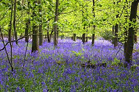
Bluebells in Cowleaze Wood
|
|
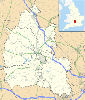
| Map | |
| Geography | |
| Location | Oxfordshire, England |
| OS grid | SU726957 |
| Coordinates | 51°39′18″N 0°56′42″W / 51.655°N 0.945°W |
| Area | 70-acre (28 ha) |
| Administration | |
| Governing body | Forestry Commission |
Cowleaze Wood is a beautiful woodland covering about 70-acre (28 ha) (which is like 50 football fields!). It's located in the Chiltern Hills, a famous chalk ridge in South East England. This wood is near the village of Lewknor in Oxfordshire. It also touches the border with Buckinghamshire.
The Forestry Commission owns Cowleaze Wood. They planted many of the trees here between 1957 and 1966. The wood is especially famous for its amazing display of bluebells in spring. Many people also visit to spot red kites flying overhead. There's a big car park and a fun picnic area with cool benches designed by Fred Baier.
A Plane Crash in the Wood
On March 31, 1944, during World War II, a Handley Page Halifax Mk III bomber plane crashed in Cowleaze Wood. This plane, named LW579, was part of No. 51 Squadron RAF. It was returning from a very long and dangerous mission called the Nuremberg Raid.
Sadly, all seven crew members on board died in the crash. The plane was based far away in Yorkshire, over 120 miles (190 km) from Cowleaze Wood. It's still a mystery why the plane lost height and crashed on a clear, moonlit night.
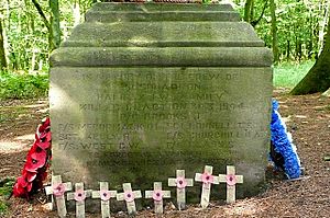
Today, there's a special monument in the wood to remember the brave crew of LW579. It's a stone base from Lincoln Cathedral, now carved with the names of the men who lost their lives. In 2015, BBC Radio Oxford even made a radio show about the crash and the crew's families.
The Chiltern Sculpture Trail
For 17 years, Cowleaze Wood was home to the Chiltern Sculpture Trail. This special trail opened in May 1990. It was a project between the Chiltern Sculpture Trust and the Forestry Commission. They wanted to place art in natural woodland settings.
The trail was about 2 miles long. It showed off artworks from many different artists. The sculptures were made especially for the wood. Many pieces were hidden, blending in with the trees and plants. Some visitors even wondered if what they saw was art or just a natural part of the forest! Sculptures included a huge picnic table and a metal "fish tree."
The sculpture trail was free to visit all year round. In 2007, it was estimated that about 80,000 people visited each year! However, the trail closed in 2007 because there wasn't enough money to keep it going. It cost about £25,000 a year to maintain. When it closed, there were 20 sculptures in the wood, and some were later sold.
Bald Hill: A Historic High Point
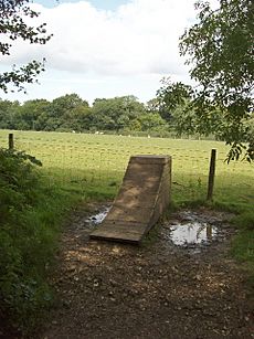
Inside Cowleaze Wood, you'll find a spot called Bald Hill. This hill used to be the highest point in the historic county of Oxfordshire. It stands about 843 feet (257 m) above sea level.
However, in 1974, county boundaries changed. A different hill, Whitehorse Hill, became the new highest point. Whitehorse Hill is slightly taller at 856 feet (261 m). Even though Bald Hill isn't the highest anymore, it's still a special place for people who enjoy "Hill bagging" – a hobby where people visit the highest points of different areas. It can be a bit tricky to find the exact spot, though!
 | Bessie Coleman |
 | Spann Watson |
 | Jill E. Brown |
 | Sherman W. White |


