Craig Gwrtheyrn facts for kids

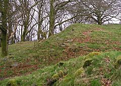
The entrance to the fort
|
|
| Location | Near Llanfihangel-ar-Arth, Wales |
|---|---|
| Coordinates | 52°2′18″N 4°17′7″W / 52.03833°N 4.28528°W |
| Type | Hillfort |
| Area | 1.5 hectares (3.7 acres) |
| History | |
| Periods | Iron Age |
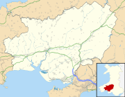
Craig Gwrtheyrn (pronounced "Craig Gur-THAIRN"), also known as Caer Gwrtheyrn, is an ancient Iron Age hillfort. It is found in Carmarthenshire, Wales, close to the village of Llanfihangel-ar-Arth. This old fort sits on a hill overlooking the River Teifi.
Contents
What is Craig Gwrtheyrn?
This hillfort is built on a very impressive hill. It gives great views over the River Teifi. The fort's defenses stretch about 160 meters (525 feet) from north to south. They are also about 125 meters (410 feet) from east to west. The fort covers an area of about 1.5 hectares (3.7 acres).
How was the fort protected?
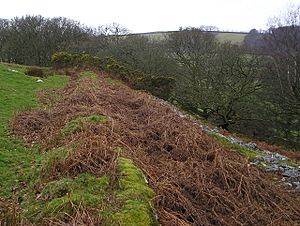
The fort had a strong wall made of dry stone. This wall, called a rampart, was originally 2 to 3 meters (6.5 to 10 feet) thick. You can still see parts of it today.
Around the rampart, there was a deep ditch. This ditch helped to stop enemies from getting in. Stones from the rampart have fallen into this ditch over time. The north-east side of the hill was very steep, so it did not need a ditch.
The Fort's Entrance
The main entrance to the fort is on the south-west side. Here, there are two extra banks of earth. These banks create a special protected entryway called a barbican. A barbican makes it harder for attackers to get inside.
There is also a small area of chevaux de frise (pronounced "sheh-VOH duh FREEZ"). This is a defense made of sharp stones. These stones were set upright in the ground. They were meant to hurt anyone trying to cross them. About 30 of these sharp stones can still be seen today.
The Legend of Vortigern
Craig Gwrtheyrn means "Vortigern's Rock." Caer Gwrtheyrn means "Vortigern's Castle." Both names connect this place to a famous British warlord named Vortigern. He lived in the 5th century. It's not clear if Vortigern was a real person or a legend. Many old stories talk about him.
Vortigern's Story
One popular story about Vortigern comes from a book called Historia Brittonum. This book was written in the 9th century. It says that Vortigern was running away from a holy man named St Germanus. Vortigern built a castle on the River Teifi to hide.
But St Germanus followed him. The story says that St Germanus prayed, and fire came down from heaven. This fire set Vortigern's castle alight. Vortigern, his family, and everyone else inside the castle died in the fire.
Other Tales
There are other versions of how Vortigern died. People also claim he was buried in different places. We don't know if the hillfort was named after this legend, or if the legend came about because of the fort's name. It's a mystery that makes the fort even more interesting!
 | Audre Lorde |
 | John Berry Meachum |
 | Ferdinand Lee Barnett |


