Cresbard, South Dakota facts for kids
Quick facts for kids
Cresbard, South Dakota
|
|
|---|---|

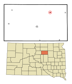
Location in Faulk County and the state of South Dakota
|
|
| Country | United States |
| State | South Dakota |
| County | Faulk |
| Incorporated | 1909 |
| Area | |
| • Total | 0.42 sq mi (1.08 km2) |
| • Land | 0.41 sq mi (1.07 km2) |
| • Water | 0.00 sq mi (0.01 km2) |
| Elevation | 1,450 ft (440 m) |
| Population
(2020)
|
|
| • Total | 96 |
| • Density | 231.33/sq mi (89.38/km2) |
| Time zone | UTC-6 (Central (CST)) |
| • Summer (DST) | UTC-5 (CDT) |
| ZIP code |
57435
|
| Area code(s) | 605 |
| FIPS code | 46-14580 |
| GNIS feature ID | 1267340 |
Cresbard is a small town located in Faulk County, South Dakota, in the United States. In 2020, about 96 people lived there. It's a quiet place with a rich history.
Contents
Where is Cresbard?
Cresbard is a small town that covers about 1.08 square kilometers (or 0.42 square miles). Almost all of this area is land. It's a flat area, typical of the farming regions in South Dakota.
How Many People Live in Cresbard?
The number of people living in Cresbard has changed a lot over the years. Here's a quick look at how the population has grown and shrunk:
| Historical population | |||
|---|---|---|---|
| Census | Pop. | %± | |
| 1910 | 320 | — | |
| 1920 | 349 | 9.1% | |
| 1930 | 358 | 2.6% | |
| 1940 | 288 | −19.6% | |
| 1950 | 235 | −18.4% | |
| 1960 | 229 | −2.6% | |
| 1970 | 224 | −2.2% | |
| 1980 | 221 | −1.3% | |
| 1990 | 185 | −16.3% | |
| 2000 | 143 | −22.7% | |
| 2010 | 104 | −27.3% | |
| 2020 | 96 | −7.7% | |
| U.S. Decennial Census | |||
Population in 2010
In 2010, the town had 104 people living in 61 homes. About 34 of these were families. The town had 85 housing units in total. Everyone living in Cresbard at that time was identified as White.
Most households were made up of individuals or married couples. A small number of homes had children under 18. The average age of people in Cresbard was about 63.5 years old. Many residents were 65 or older.
A Look at Cresbard's History
Cresbard celebrated its 100th birthday in 2006. The town started in 1906 when a railway line was built through the area. It officially became a town in 1909. The name "Cresbard" comes from two local family names, Cressey and Bard.
In its early days, Cresbard was an important center for farming. Farmers would bring their grain and livestock here. By the 1920s, Cresbard became known for its excellent school district. The school served several smaller communities nearby. In the 1950s, the school's band won national awards. Its sports teams also won state championships.
Changes Over Time
The railway line closed down by 1940. State Highway 20 then became the main road connecting Cresbard to other places. After World War II, the number of people living in the area slowly started to decrease. This was because the farming economy changed.
The school's student population also dropped. From a high of 350 students in the 1960s and 70s, it fell to less than 100 by the late 1990s. By 2004, the town's total population was only 121. Because of this, the high school closed in 2005.
Today, Cresbard is still a small town. A big part of its economy now comes from services for people who come to hunt pheasants, ducks, geese, deer, and buffalo.
The town also has a hotel, a restaurant, a museum, an auto shop, and a bank. There are also two churches and a local fire and rescue service. Cresbard is surrounded by farmland, showing its strong connection to agriculture.
See also
 In Spanish: Cresbard (Dakota del Sur) para niños
 | Charles R. Drew |
 | Benjamin Banneker |
 | Jane C. Wright |
 | Roger Arliner Young |

