Cromona, Kentucky facts for kids
Quick facts for kids
Cromona, Kentucky
|
|
|---|---|
 |
|
| Country | United States |
| State | Kentucky |
| County | Letcher |
| Elevation | 1,332 ft (406 m) |
| Time zone | UTC-5 (Eastern (EST)) |
| • Summer (DST) | UTC-4 (EDT) |
| ZIP codes |
41810
|
| GNIS feature ID | 490366 |
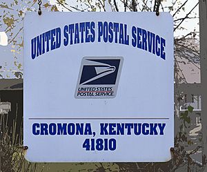
Cromona is a small community in the mountains of Eastern Kentucky, in Letcher County. It is an unincorporated community, which means it doesn't have its own local government like a city or town. The Cromona post office has been open since 1916.
Even though the post office is called Cromona, local people often call the area Haymond. This community was built in 1916 as a coal town, a place created to support coal mining. It was named after Thomas S. Haymond, who was the president of the Elk Horn Coal Corporation. In 2010, about 502 people lived in Haymond.
Contents
What's in a Name? The Story of Cromona
It might seem strange that the post office has a different name than the local community. This was actually a common issue in the United States a long time ago. In the late 1800s, many post offices had names that didn't match the local place. The government tried to fix this by changing thousands of names, but some differences still exist today. For example, a nearby town called Hemphill has a post office named Jackhorn.
So, where did the name "Cromona" come from? No one knows for sure. Some people think it might be connected to Cremona, Italy. This Italian city is famous because Stradivarius built his amazing violins there. You might wonder what a small Kentucky town has to do with Italy.
Well, in the early 1900s, many skilled Italian stonemasons worked in Letcher County. They built important buildings and churches, some of which are still standing. It's possible the post office name was chosen to honor these talented builders.
Where is Haymond? Geography Explained
Haymond is located at 37°11′11″N 82°41′50″W. It sits in a narrow valley, with tall mountains all around it. The land can change by over 1,000 feet from the valley floor to the mountaintops. A small stream flows through Haymond, running mostly next to the main road, SR-805. Haymond is bordered by Tollivertown to the west and Potter's Fork to the east.
Who Lives Here? Understanding the Population
Based on the 2010 US Census, 502 people lived in Haymond. The population was almost evenly split, with 50.2% male and 49.8% female. The median age was 43.0 years, which means half the people were older than 43 and half were younger.
Getting Around: Transportation in Haymond
The main road in Haymond is SR-805. It's a two-lane highway that helps people travel through the community.
Local News: Keeping Up with Haymond
The local newspaper, The Letcher County Community New-Press, has its office in Haymond. This helps residents stay informed about what's happening in their area.
Famous Visitors: A Senator's Stop
On February 14, 1968, U.S. Senator Robert F. Kennedy visited Haymond. He was a well-known politician and brother of former President John F. Kennedy.
Exploring Haymond: Fun Local Landmarks
Haymond has several interesting places that locals know well:
- Skyview Park: This is a community center located in Ramey's Fork. It also has a baseball field, which is great for sports and outdoor fun.
- School House Hill: This is a very steep hill behind the Haymond Post Office. The old Haymond school used to be here, but it closed over forty years ago. For many years, this hill was a popular spot for local kids to go sledding in the winter.
- Ramey's Fork: This area was home to Boy Scout Troop 72 for many years. Because of the Boy Scouts, Ramey's Fork is also known as Scout Hollow.
- Bear Hollow: This area is also located behind the post office. While many online maps call it Highland Branch Road, many local people still use the name Bear Hollow.
- Number Six: This is a pond in Ramey's Fork that was a popular swimming spot for many years. It got its name from the old #6 mine that was nearby.
- The Back Alley: This is a smaller street off SR-805. It's mentioned in a book by Sarah Hagen-Cornett.
 | Roy Wilkins |
 | John Lewis |
 | Linda Carol Brown |


