Crooked Creek, Georgia facts for kids
Quick facts for kids
Crooked Creek, Georgia
|
|
|---|---|
| Country | United States |
| State | Georgia |
| County | Putnam |
| Area | |
| • Total | 3.83 sq mi (9.93 km2) |
| • Land | 3.23 sq mi (8.37 km2) |
| • Water | 0.60 sq mi (1.56 km2) |
| Elevation | 420 ft (130 m) |
| Population
(2020)
|
|
| • Total | 685 |
| • Density | 212.01/sq mi (81.86/km2) |
| Time zone | UTC-5 (Eastern (EST)) |
| • Summer (DST) | UTC-4 (EDT) |
| ZIP code |
31024
|
| Area code(s) | 706 & 762 |
| GNIS feature ID | 2587031 |
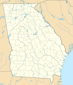
Crooked Creek is a small place in Putnam County, Georgia. It is known as an unincorporated community. This means it is not officially a city or town with its own local government. It is also a census-designated place (CDP). This is a special area the government defines just for counting people.
In 2020, about 685 people lived in Crooked Creek. This community is located on the west side of the Oconee River.
About Crooked Creek
Crooked Creek is found in the state of Georgia, in the United States. It is part of Putnam County. The area covers about 9.93 square kilometers (3.83 square miles). Most of this area is land, but some is water. The community sits at an elevation of about 420 feet above sea level.
Population and People
The United States government counts how many people live in different places every ten years. This is called a census. Crooked Creek was first counted as a census-designated place in 2010.
| Historical population | |||
|---|---|---|---|
| Census | Pop. | %± | |
| 2020 | 685 | — | |
| U.S. Decennial Census 1850-1870 1870-1880 1890-1910 1920-1930 1930-1940 1940-1950 1960-19801980-2000 2010 2020 |
|||
In 2020, the population of Crooked Creek was 685 people. Most of the people living there were White. There were also smaller groups of Black or African American people, Asian people, and people of mixed races. Some residents were also of Hispanic or Latino background.
See also
 In Spanish: Crooked Creek (Georgia) para niños


